

Quick News
Quick Finder (Follow links for more information)
Noteworthy Developments
Bathwick Street
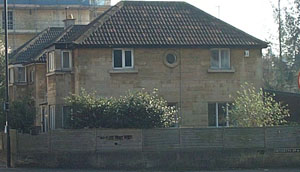 On 29th September 2010, planning permission for application 07/03669/CA to demolish the existing buildings was granted, subject to the condition that no demolition can take place until a valid contract (with planning permission) is in place to construct the replacements. The corresponding new build application 07/03670/FUL, was delayed pending the conclusion of S106 negotiations, until permission was finally granted on 12 January 2011 with an agreement to contribute sums of money towards highways and open space and/or allotment provision.
The permission included an obligation for an archaeological investigation before building work could commence, because Roman remains were believed to exist in the area. That exploration appears to have started, because the three detached houses: Byways, Cleve and Linden have been demolished in order to excavate near and under their foundations.
 The demolition of perfectly sound houses is regrettable but the replacement development provides more dwellings in a set of family sized units with two or three bedrooms, coupled with more parking spaces than there are flats, which is a welcome change to the general tendency to pack in as many one bedroom flats as possible into a development. Watchdog supported this development, accepting the demolition of the existing houses for the greater good.
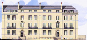
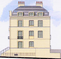
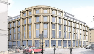
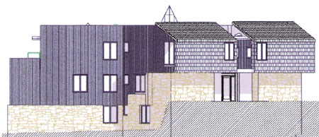
The design is not perfect. Each ground floor tall rear window should ideally be two windows, separated by a stone course to echo the proportions of the floors above, and the building could ideally sit a little lower in the site so that fewer steps are needed to reach the entrances. But these defects are not enough to spoil the effect, and the nice touches like the pediments over the first floor windows above the entrances (pictured above left), and the detailing of the Henrietta street elevation (pictured above right) remove any suggestion of a utilitarian design. The appearance might not be welcomed by architectural purists, but it has "Bathness" and the developers are to be congratulated for that.
Go back to top index
Beau Street
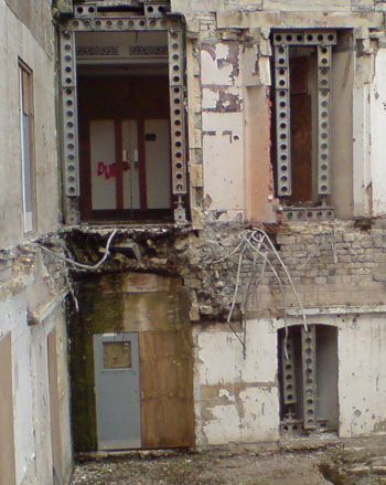
![]() [12/6/11] After our previous concerns about the state of the listed building in 2009 (see below) the site was tidied up and the building was reasonably well tended. Although we would dearly like to see the work resume and continue to completion, it did look as though enough was being done to prevent any further deterioration to the historic fabric.
[12/6/11] After our previous concerns about the state of the listed building in 2009 (see below) the site was tidied up and the building was reasonably well tended. Although we would dearly like to see the work resume and continue to completion, it did look as though enough was being done to prevent any further deterioration to the historic fabric.
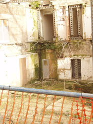
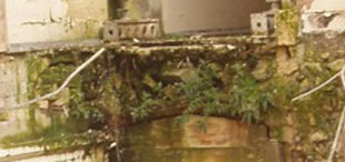
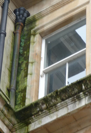
That changed early in June 2011 when we were alerted to the fact that pigeons had been seen flying in and out of the building. This can be serious. Pigeon droppings are acidic and corrosive. Outside in the open where the rain can wash them away they are an inconvenience, but inside where they can remain, they can do damage. Structures under load such as staircases are particularly vulnerable.
The three pictures show the wildlife access available at Basement, Second floor and fourth floor levels (though no pigeon would pose on the fourth floor while we were there). The second floor window might possibly be open to the sky on both sides, though it is not easy to see with the position of the hoardings. However the others do give access to the interior, and the openings are unlikely to be accidental.
The real concern is that it is not just pigeons that can gain entry. If bats take up residence inside, the the legislation protecting bat habitats will make it extremely difficult to continue the conversion to a hotel. If there really is a need to provide ventilation by opening windows and doorways, the very minimum required is to cover the openings with mesh to prevent access by wildlife.
 [27/9/09] By
September 2009, new growth had reached a significant size. The picture on the right shows that high level weeds have grown as well as ground level ones.
[27/9/09] By
September 2009, new growth had reached a significant size. The picture on the right shows that high level weeds have grown as well as ground level ones.
 The picture on the left is a close-up of the main cluster of weeds below the first floor doorway. This is mostly Buddleia, which has particularly strong roots that can penetrate gaps between or across stones. As the shrub matures, the roots expand, and would be capable of prizing apart the stones they are growing from.
It is important therefore that these weeds are removed as soon as possible. This is still a listed building even though it is in the process of development, and the site owner has an obligation to protect the historic fabric that the plans for the development show is to be retained.
[17/5/09] In March, Watchdog reported the invasive weeds that could affect the structure of the listed Gainsborough building if they were allowed to get established. We were particularly concerned about the Buddleia which grows roots strong enough to prise apart stone and the fact that where it was growing were originally internal walls, so that stone would not have been weathered to as hard a surface as external walls.
We are pleased to report that after we brought the risks to the attention of others, including SAVE, of which Watchdog is a member, workmen have been seen removing the weeds. So we are saying thank you with some before and after photographs (though the pedestrian barriers are now in slightly different positions so it was not possible to take the recent ones from exactly the same viewpoint, but we have done our best).
March |
May |
|
|
|
|
|
|
|
|
 *
*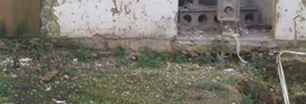

Credit where credit is due, we are delighted with the improvement of the May pictures compared with the March ones.
 Unfortunately it doesn't cover all the areas of concern. The problems with the leaking rainwater goods pictured left and right are still outstanding, and both of these must be causing internal problems due to damp penetration.
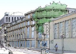
But our biggest concern is the face that no construction work is currently taking place. Tourists are already confronted by a partially completed Southgate of they arrive by bus or train, but at least they can see that it is work in progress and men and machines are hard at work. The Gainsborough site is just a little further away, but being located opposite the Thermae Spa it is going to be seen by many of them. And unfortunately, it looks like a derelict site: no plant, very few workmen (just one occasionally putting weeds in a skip when we last looked). It is currently not an asset to the World Heritage Site.
Meanwhile, there is a proposal to connect Bellots Hospital to the Gainsborough Building (application 09/00283/FUL), which omits all reference to how such a link can be made without shoring and underpinning the gaps that would be made in the foundations of both buildings, and without any assessment of how such an excavation might affect the flow of the hot springs which reach the surface only a few feet away from where deep holes would be dug. Despite the incomplete documentation, the Case Officer approved the plans, and we can only assume that what we read in the drawings and what he imagined in his head when he wrote his report are vastly different. Certainly we can find no evidence to back up his assumptions.
Given how little progress this developer seems to have made so far to complete the work on the Grade II listed Gainsborough Building, we really fear for the survival of Bellot's Hospital in its current habitable state if planning permission is granted with so many questions unanswered; and we certainly have no desire to see a risky excavation that might disrupt the supply of hot water to the Thermae Spa. The Springs Foundation need to study these plans very, very carefully.
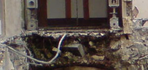
[15/2/09] Watchdog has met the developer, Trevor Osborne, and has been reassured that the delay to the work was unavoidable and the development should resume soon. We have been keeping a photographic eye on things though, and the difference five months has made is very marked:
The stonework that was facing into the building is growing a very similar algae to the Southgate shops. A former stonemason informed us that Bath Stone, when cut properly, encourages any penetrating water to migrate towards the outside of the building, where what does not run off evaporates. Internal stonework does not have to be cut so accurately because it doesn't face the weather.
So the internally facing stone now exposed to the weather during the extended gap between demolition and reconstruction appears to be getting waterlogged, which is permitting algal growth. Even if there is good reason why the development cannot proceed yet, we urge the developer to protect any inward facing stonework from further attack from the weather: waterlogged Bath stone becomes friable in time.
We also wonder about the similarities with Southgate. Could it be that the knowledge built up over centuries by the local stonemasons of the correct bias for cutting Bath Stone to make it weather resistant, has not been communicated to the Italian company preparing the cladding for Southgate?
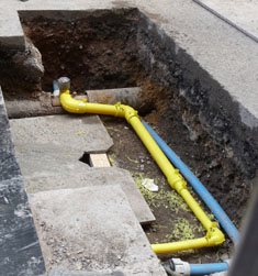 We were encouraged by the sight of scaffolding and workmen outside the Gainsborough Building
and protective hoardings were erected during the week 11th to 17th September, and we spoke to the contractor to find out exactly what they were doing.
Our hopes that work was restarting on this building that had become a long-standing eyesore were dashed when we discovered that the workmen were not working on the building itself, but only on the springs beneath.
We were encouraged by the sight of scaffolding and workmen outside the Gainsborough Building
and protective hoardings were erected during the week 11th to 17th September, and we spoke to the contractor to find out exactly what they were doing.
Our hopes that work was restarting on this building that had become a long-standing eyesore were dashed when we discovered that the workmen were not working on the building itself, but only on the springs beneath.
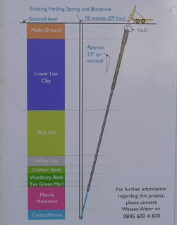 The work that is just within camera range is a set of pipes, including (just visible on the far side of the trench) a supply into the Gainsborough building. What we couldn't see but we were told about is that Beau Street, in common with much of central Bath, is a road surface supported on historic vaults. From the underlying ground level beneath the vaults, a bore hole is to be drilled at a slight angle from the vertical so that at a depth of 70 metres it meets the hot springs. Once completed and connected up, the Gainsborough will have its own supply of hot spring water.
It follows that there would be no point in the effort and expense of constructing such a supply unless the hotel and its pool were to be completed and opened for business. It does suggest that work on the Gainsborough Building might be restarting in the foreseeable future.
The contractor said that some information boards were being prepared. When these were put in place just days after our original visit, they showed in pictures (one of which is reproduced above left) what we have tried to explain here in words.
After all the time that this building has been exposed to the weather, there must be some considerable deterioration of the fabric, and it should perhaps be considered a candidate for the Buildings at Risk register.
[27/10/11] Following the news item in the Chronicle reporting that the Gainsborough development was now in new hands, we received a message assuring us that the new owners intended to develop to the original plans that were given permission. We regard that as good news, and completion of the work already started will protect what remains of the listed building from further deterioration. We recognise that the new owners have to understand what will be a complex project and cannot start work on site until they do, and we hope that until then there is not a lot of severe weather.
Go back to top index
Broad Street: King Edward's School.
Planning Applications 10/00041/FUL and 10/00042/LBA were for the conversion of the former school into a Hotel, with a Restaurant and Bar also open to non-residents. The Development Control Committee considered both applications on 29th September 2010.
 Watchdog was in a slightly awkward position because we thought the work to the listed building was sympathetic and we wanted to speak in support, whereas we had some reservations about the FUL application and wished to speak against; yet both applications were to be discussed together We opted to speak against but to make it clear that we did not object to the listed building application.
The Case Officer reminded the committee that the building was vacant and on the "At Risk" register. It was also announced that there was an Update Report, but unfortunately it was not made available to the Public Gallery nor to the Watchdog Chairman who was to speak. In hindsight, had we seen it before speaking, it would have shown that some of our concerns were addressed by one of the proposed new conditions and an amendment to one of the recommended conditions in the main report. Effectively it meant that it would not have mattered if we had chosen not to speak, but we couldn't have known that.
The first to speak against was a representative of the Circus Area Residents Association. The committee were informed of their concerns about possible alcohol fuelled antisocial behaviour. He reminded the committee that this area was an antisocial behaviour hotspot He informed them that the limit on persons using the terrace had not been carried forward [it had - it was in the update report; but he couldn't have known that at the time] and this was a concern that needed to be corrected. He wanted to tighten Condition 2 to ban all music.
The next to speak against was a representative of the Abbey Residents Association. The committee was reminded that there were a number of residences in this area and other accommodation for visitors, so his Association was very concerned that the building mihgt be less of a hotel and more of a boozer. Therefore the conditions proposed were essential and must be strictly observed. He thought that there should be a condition limiting the size and number of bars and a ban on amplified music.
Watchdog's Chairman spoke last. He commended the sensitive solution to reusing the listed building The concern was the impact on the character of the Conservation Area and the amenity of the local residents if conditions are imposed but not enforced. (The allotted time ran out at this point because the previous speakers had slightly overrun, but since between them they had already covered the points in the remainder of the Watchdog speech, nothing was lost).
The Applicant's Agent spoke in support. He gave a brief history of the building and of the brewery that now owned it. He emphasised the company's traditional approach to hospitality, hence the suggested King Edwards Tavern name and the care taken to safeguard the condition of the building. He reminded the committee that the proposals had the support of a good number of the public, from English Heritage and the Georgian Society. He reminded the committee of the care taken over the company's restoration of a listed building in Gloucester and asked that the proposals be judged on their merits and not speculation. He said that it was company policy not to have amplified music.
Cllr Brian Webber said that the building had been empty far too long. He reminded fellow Members that it was important not to confuse the roles of planning and licensing despite both being administered by the council, and in his view the conditions as proposed and amended in the Update Report were adequate. Nevertheless he thought that the concerns by local residents about potential noise problems were valid and he would like to see a total ban on music in the courtyard and he wondered if there was scope for separate approval of lighting [There would have to be because there was no drawing of the lighting installation in the application before the committee.] Despite these small concerns, he moved to support the Officer recommendation to grant consent subject to conditions.
Cllr Gerry Curran seconded. He noted that Condition 8 dealt with lighting. He thought that this was an important building and that its future was a concern to many, so he supported the proposals as an acceptable solution for the former school. He too thought it was important not to anticipate what the Licensing Committee might decide.
The Development Manager advised that conditions regarding amplified could be imposed but non-amplified music could not reasonably be controlled. If it became a problem there were mechanisms for dealing with it.
Cllr Colin Darracott said that it was a pity that the applicant had delayed, because there was a lost opportunity to merge these proposals into the Shires Yard/Milsom Place scheme. He recognised the problems with non-amplified music and the difficulty in drawing distinctions between organised singing or playing of instruments and spontaneous occurrences.
At the vote, both applications were passed by 11 votes to nil.
Within a month of gaining planning permission, a further application 10/04713/VAR was raised, attempting to have removed some of the conditions attached to the permission granted which restricted the hours of use of the bars and outside courtyard and the number of persons allowed to use the courtyard at any one time. That application was withdrawn in February 2011 after the applicants were informed that they were unlikely to get what they wanted approved.
So the building remains unused, as it has been for many years. The letter requesting withdrawal said that the use of the building with the restrictions still in force would not be commercially viable, something that some of the speakers at the DCC had privately suspected. Nevertheless, the conditions were imposed to protect the amenity of the neighbourhood residents, and they were quite rightly upheld. It remains to be seen what happens next.
Go back to top index
Belushi, Formerly St Christopher Inn - No.9 Green Street
This item is the story of a sad tale of a listed building badly treated by owners who are ignoring all the legislation intended to protect heritage assets. It started when Belushi's took over the former Oliver Inn, gutted the inside and painted the outside, all without listed building consent.
[16/11/08] Two planning applications: 08/04001/LBA for listed building consent and 08/04000/FUL for planning permission were for retrospective permission for the changes already made.
 This Listed Building shop front had been repainted. New Fascias had been installed. New signs had been installed. New swan-neck lighting had been added to the outside, with visible wiring strung along the outside of the building. The historic balustrades had been covered in gloss paint.
According to the applicant, the brass swan-neck illumination was fitted by a previous owner about two years before. But take a look at the photograph on the right, which was taken in September 2008 and it is apparent that the lighting was installed after that date. For lying in the documentation, this application should be instantly rejected.
The colours chosen are not from the palette normally enforced for listed buildings in the central area. The swan-neck lighting is specifically mentioned in the council's Shopfront Guide as unacceptable in any circumstances, as is visible wiring; illuminated signs are mentioned in the Guide as usually unacceptable.
The Listed Building application has no historical survey, which would have shown what was originally in place, which would have made the evaluation of the changes very much easier.
 [28/12/08] On 17th and 18th December 2008 respectively, the full application and the listed building application were both refused. The swan-neck lighting (pictured right), which is a style particularly identified as always inappropriate in the council's Shopfronts Guide, were rejected as harmful to both the listed building and the Conservation Area.
[25/1/09] On 12th January 2008 two more (retrospective) applications were lodged, described as "External alterations for the redecoration of fascia and facade at ground level to two elevations including replacement lighting to fascia signs and new signage ". The swan-neck lighting is to be replaced by trough lighting. There is still no sign of any planning applications to cover the internal alterations that were made without planning permission.
The two planning applications: 09/00090/LBA for listed building consent and 09/00089/FUL for planning permission were raised for retrospective permission for the external changes made, although the detail in the documentation points out that the trough lights proposed are new
The colours chosen are not from the palette normally enforced for listed buildings in the central area. The trough lighting remains unnecessary because this whole area is one of low luminance. The Listed Building application again had no historical survey, which would make the evaluation of the changes very much easier.
[22/3/09] On 16th March 2008, application 09/00090/LBA was refused permission. This means that the retrospective application to change the building colour fails along with the proposal for external lighting. The change of colour therefore once more becomes an enforcement issue, see the Enforcement page.
[19/4/09] On 12 January 2009, Belushi's raised a retrospective planning application for the redecoration of the shopfront and the introduction of trough lighting, in response to the Enforcement Officer complaining that they had done so without permission. On 17th April, planning permission was refused on the grounds that it was inappropriate for the listed building. Enforcement action should now be resumed.
Go back to top index
James Street West
On Thursday 25 April 2013 a public exhibition was held in the Bath Society Meeting Room in Green Park Station. Everybody who attended was encouraged to fill in a feedback form, because such comments would be quoted as a Public Consultation document which will form part of the planning application that will probably be raised early in the summer.
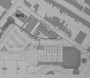 The site is that currently occupied by two office buildings (the NHS Walk-in Centre is not affected), and these are to be demolished, with two student accommodation blocks built in their place, filling most of the site, stretching from very close to the pavement edge to very close to the boundary with the Sainsbury's site, close to where Sainsbury's have said they want to build housing.
We were told that what we saw on the exhibition boards was just a concept at this stage, but if a planning application is to be raised in the timescale quoted, the designs have to be considered to be fairly representative of the plans that will be submitted. That said, we were led to believe that modifications were still possible.
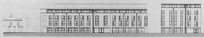
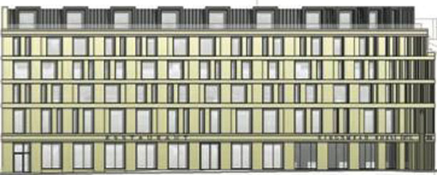
There are some good things in the layout. The student blocks on the Lower Bristol Road are all single occupant rooms, and some students would rather share than live alone. The plans we saw included "cluster flats" which were linked rooms behind an access door for five people sharing. These flats provided 30% of the total 185 students to be accommodated. There was no provision for couples, so students wishing to live with a partner were not catered for. There are only two parking spaces for disabled vehicles, which seems rather small for a population of 185. There were other drawbacks too.
 There
was an illustrative view from the road, which allowed the comparison with Green
Park Station (in the left of this picture) to be made. Very clearly it does not comply with the building heights restrictions that form part of the draft Core Strategy. Nor does the style comply with the local vernacular of its surroundings. There are Local Plan policies and Supplementary Planning Documents which should rule out the plans as exhibited being granted permission. In case there is a thought that the common good arising from the expectation that HMOs will be released back into the housing market, is sufficient to justify overriding such policies we offer the following observations.
There
was an illustrative view from the road, which allowed the comparison with Green
Park Station (in the left of this picture) to be made. Very clearly it does not comply with the building heights restrictions that form part of the draft Core Strategy. Nor does the style comply with the local vernacular of its surroundings. There are Local Plan policies and Supplementary Planning Documents which should rule out the plans as exhibited being granted permission. In case there is a thought that the common good arising from the expectation that HMOs will be released back into the housing market, is sufficient to justify overriding such policies we offer the following observations.
The idea that HMOs can be returned to the housing stock is barely credible. To squeeze in as many renting occupants as possible (in the knowledge that the council never enforces the legal limit of six residents without planning permission), the internals have generally been so altered that the property becomes wholly unsuitable for occupation by a family, and restoring it to a home would be dauntingly expensive. Once ruined as a family home, an HMO will stay ruined.
In common with other student blocks, there would be a tenancy agreement banning residents from bringing cars, and in common with the other student blocks this will prove to be unenforceable and regularly flouted. While the policy remains that student accommodation shall be without parking provision, the expectation that HMOs in other areas will be freed up by purpose-built blocks will never be realised. Whilst there is no need for a car during term time, a car remains far cheaper and more convenient than public transport for moving students and luggage between their home and their accommodation in Bath, and while student accommodation all has an anti-car policy, HMOs will remain the accommodation of choice for many of them. Residents Parking schemes don't alter anything: if a car is only needed once every few weeks, it is no hardship to park it on the outskirts outside the controlled zone and leave it there until needed.
For those who do occupy the accommodation and are ferried there and back home by relatives, there is a beginning of term and end of term flood of vehicles to be handled, and although the developers are in discussion with the Highways Department, at the time of the exhibition there was no clear policy for how that flood of arrivals and departures would be handled; and if it is handled badly, this is entirely the wrong street for traffic to clog it up.
We left our feedback, and it remains to be seen whether anything we said finds its way into the application documents when they are eventually submitted.
Go back to top index
Kingsmead House
From the exhibition
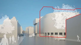
Comparing the scale of the existing building (red outline) with the suggested building (white silhouette)
[8/8/10] At the end of July, a consultation in the form of a public exhibition of ideas for the Kingsmead House site was held in the foyer of the building. Watchdog discussed the impressions of the Kingsmead exhibition at the meeting on 2nd August, and reached a consensus view among our members who went along. Those comments have been sent to Scott Brownrigg.
For those who didn't get to the exhibition, despite its announcement in The Chronicle, the exhibition boards have been reproduced on the Telereal Trillium website. Be warned though that the download file link shown on that page fetches nearly 9 megabytes of file, which is unrealistic for a dial-up connection and is a significant size for anybody with a capped broadband service. If you do read the file, it contains all the exhibition boards in sequence. We haven't spotted a deadline for comments in the documentation, but recommend that anybody who wants to have an input into the consultation process does so by mid-August to make sure those views are taken into account.
[16/1/11]] Despite all our efforts, when the latest plans were first seen it was obvious that the consultation had been a tick-box exercise and there had been no intention of modifying plans after the public's opinions had been sought. This is how we reported to our members at the time:
Last summer, several Watchdog members went along to the public consultation for the hotel proposed in place of Kingsmead House, and made a number of suggestions to improve what the architects claimed were "illustrative only" montages. Now that the designs have been submitted as a planning application, amid statements that the comments from the consultation have been taken into account, we are presented with what looks like a computer generated clone of a Western Riverside block, virtually untouched by any aesthetic considerations or the characteristics of the nearby listed buildings, and in some ways worse than some of the "options" originally exhibited. Given that the hotel that has planning permission to be built on the Green Park House site has some feel of "Bathness" to its external appearance, we can't imagine that this hotel just along the road with an external appearance more akin to an office block would be a naturally sought-after destination for tourists, no matter how luxurious the inside might be. Tourists don't visit Bath to see modern buildings.
Watchdog submitted four pages of comments and suggestions, and so it was disappointing to see that the only ones taken up satisfactorily were those referring to the interior facilities. We had asked for a further consultation before a planning application was lodged; we did not get one.
[6/3/11] The plans formally lodged for the demolition of Kingsmead House and its replacement with a hotel appeared on-line. Despite the prominence of the existing building, and the number of people who must walk past it every day, very few public comments had been made on the demolition application (10/04868/CA), or the application for the hotel to replace the existing building (10/04867/FUL). There is a lot wrong with the proposals, and we expected a bigger public reaction to them. Since then, more public comments have appeared (some listed as "Application Form") but we still considered a feature to be worthwhile.
However our attention was brought to a new campaign website (not ours, but we do support the campaign), which covers everything we would have said. So click on this link to the campaign website and read a thorough analysis of the scheme. A lot of hard work and detailed research has obviously gone into it.
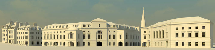
To supplement this excellent website we have assembled these views of the two sides of Charles Street to the equivalent height scale. It is not sufficient to count the storeys, the comparative difference in height of each storey makes a significant contribution to the overall impact.
 .
.
We think the application for demolition should be refused or deferred until a design for a replacement that is respectful of its listed neighbours is produced. The council's Building Height Strategy for this location says:
• "Recommended heights are related to the existing prevailing heights of Georgian buildings in the immediate area and are defined in absolute metres" so judgements based on the number of storeys should not be made.
• "Buildings should take their design cues from nearby Georgian buildings in relation to scale, site coverage, built form, grain, rhythm, roof detail and form, materials and colour" so a completely different architectural style reminiscent of a bar code should not be permitted.
• "The overall height should not be less than or exceed the overall prevailing height of nearby Georgian buildings". Note that the height of Plymouth House or Rosewell Court cannot be used to justify the scale of the proposed building because the nearby Georgian buildings are in Charles Street, New King Street and Monmouth Street.
[19/5/11] The Chronicle published a news item with pictures of a proposed amendment to the design of the building (see below) and had asked Watchdog for a comment.
Watchdog provided two comments, a full one and a shorter one if space was at a premium, and the Chronicle used the shorter one. So we give here the full comment that wasn't used.
For a proper analysis of the changes proposed we will wait for the scale drawings, but some opinion can be offered on the pictures provided. There are some positives about the changes introduced. The facades have a more regular detailing which adds a rhythm that wasn't there before.
However the claim of reduced height seems to based on optical illusion rather than fact. The James Street view shows two additional stories set back from the main facade. The scale is wrong because the stories themselves are each oversized so that four apparent stories forming the facade are the height of the six storey building further along the street. The Charles Street also seems to have at least one set back storey. The council's Building Heights Guide requires new developments to be the same scale as nearby listed buildings, and this proposal dwarfs both Charles Street and Green Park Station.
The other criticism is that the building still occupies the site right up to the pavement edge, which coupled with the over-height storeys will make it too massive, almost overpowering for passing pedestrians. The hopes of restoring the historic grain of Kingsmead Street some time in the future will be blocked by this building.
In summary, artist's impressions are only a guide so these comments are just an initial reaction. Whilst the improvements are welcomed, and is good to see an attempt to meet earlier criticisms, the proposals are still not acceptable by virtue of its height, scale, and mass.
It should be noted though that the planning applications have not been updated with new drawings at the time this section was written, so at present these must be regarded as just publicity sketches, and neither are our comments a formal statement for the planning applications.
 At almost the same time, the University of Notre Dame sent us a picture to go with their Press Release about their presentations to Bath. It covers a wider area, taking the whole side of Charles Street between James Street West and Monmouth Street. However it is interesting to make the comparison between this sketch and the ones of the proposed hotel above.
[26/10/11] Unsurprisingly, because of the way the disadvantages were underplayed in the Committee Report, the DCC approved the plans for a hotel on the Kingsmead House site. An outline of the reasons was published in the Chronicle. Watchdog was not against development of the site, and was not against the construction of a hotel in principle, but we thought the scheme proposed was inappropriate for the location.
A couple of quotes from the Chronicle article are worth a mention. The first is "I think we should go ahead, if we dont we will be left with an area that has been demolished and nothing is being built there." One of our expectations of those who become members of the DCC is that they should familiarise themselves with the planning legislation they are supposed to take into account, and any brief from the Case Officer. The Planning (Listed Buildings and Conservation Areas) Act 1990 provides for conditions to be imposed that prevent demolition until a contract has been let to construct an acceptable replacement, and the recommendation by the Case Officer for this site was that demolition consent should include just such a condition. So at least one member of the DCC based a vote to approve on the fact that they hadn't read the paperwork thoroughly enough. How many others were swayed by that completely inaccurate announcement we will never know.
The other quote "The conference centre really does make me want to support it" suggests that the true nature of a conference centre is not understood. It is not just a meeting place where people in suits arrive with briefcases; conference centres host functions that sometimes include exhibits. A hotel can control the times and numbers of its own service vehicles, but can only advise guests. The first time an articulated lorry and two pantechnicons arrive late morning and park outside for a couple of hours to unload trade stands for the conference centre, it will become apparent that this was not an ideal place for one.
We think the DCC might have undermined their decision on the premier Inns proposal for James Street West with this approval. Premier Inns have appealed against their refusal which was on traffic grounds. It is likely that the Inspector conducting the appeal will conclude that if traffic is not a concern at the Kingsmead House location, it is inconsistent to use it as a reason for refusal to another proposal so near that it is included in the Kingsmead House photo montages.
We also think that when the hotel is built, the fact that it entirely fills the plot to the pavement edge will make it look overpoweringly big to pedestrians walking past, particularly when each storey is oversized compared to the Bath norm. The large roof area will make it stand out more in distant views, despite not being as tall as the much smaller roof of the existing building.
Unlike St George's Place and the Western Riverside where proper ashlar blocks were used and could be reclaimed intact in the distant future for another building, the hotel intends to use the Southgate type of stone veneer, which if the Southgate outcome is repeated creates a high proportion of wastage of an increasingly scarce natural resource, and unusable scrap at the end of the building's life. Sustainable it isn't!
Go back to top index
Lidl, Formerly Herman Miller Building - Lower Bristol Road
Roof Damage
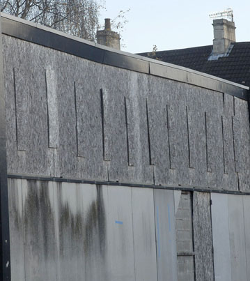 [11/12/11] Recently we were contacted with a report that the roof appears to be gradually collapsing and that when it rains a waterfall now flows over the Fieldings Road end. We went along with a camera, but unfortunately by the time we got there the flow had stopped. Nevertheless we took photographs and these clearly show that the roof is sagging in two places, and beneath one of the sags is a washed area where it overflowed.
In November we reported that planning permission for this building was stalled because the council wanted more as an S106 commitment than the owners thought was justified, and we argued that the council should back down because the building is visibly deteriorating and permission needs to be given quickly to halt the decline of this listed building.
We have reported seeing people on the roof a few weeks ago. We wonder if the sagging of the roof is connected with that. The main reason the building was listed was to preserve the Mero Spaceframe roof structure, so any deterioration of the roof is serious. Planning permission needs to be given quickly before the deterioration gets worse, particularly when Listed Building consent was first given more than two and a half years ago and the building was in much better condition then. The Building Condition Survey in application 09/00047/LBA says that "We found no significant structural defects" and the photographs accompanying it show no signs of the roof sagging, so the current damage has been directly or indirectly caused by the delay. The best way to preserve a listed building is to have it in use, and the more it costs to repair and make usable the less can be afforded as a commitment to the council. Planning decision delays are not immune to the Law of Diminishing Returns.
New 2010 Planning Application
[18/7/10] On 16 December 2009 (close enough to 2010 to almost qualify for our heading), an application 09/04842/COND was lodged to obtain clearance for some of the conditions attached to planning permission 09/00047/LBA. The conditions addressed were samples of external cladding and roof materials, details of doors and all glazing, and details of external ventilation. Those conditions where sufficient detail was provided were signed off. These included the choice by the applicant to remove the rooflights from the plans. The conditions on subdividing the internal space and the ventilation of the subdivided units remain outstanding.
On 21 June 2010 a further planning application 10/02688/FUL was lodged. This is similar to 09/02140/FUL which is still pending a decision. The main difference is that the latest application asks for change of use for the entire building (divided into four sub-units) from Industrial Use to Retail Use, whereas it's predecessor only applied for change of use of that part of the building that would be occupied by Lidl.
This apparently is the main cause of the hold-up. For reasons which we have been unable to establish, the site is in joint ownership, with Lidl and Acornford (Hampshire) Ltd each owning part. Whilst all the planning obstacles from the council's viewpoint had been addressed and permission could be given subject to a satisfactory S106 agreement, and Lidl was prepared to enter into that S106 agreement, Acornford (Hampshire) Ltd were not if it meant that they would be left with their part of the building still retained for Industrial Use. The snag was that one unit with a change of use was permitted within the planning regulations in operation in 2009, but four units with a change of use turned the building into a retail park that could not be permitted.
The solution to this impasse was the issue, in December 2009, of PPS4 ("Planning for Sustainable Economic Growth") which gave Local Planning Authorities more flexibility to agree development plans with an economically beneficial outcome. Under its terms, a new retail park can be permitted if can be shown that spare capacity in other retail centres is unsuitable. Whilst there are spare units in Southgate and there are retail units vacant in the city centre where the occupants have transferred to Southgate, none of them are ideally suited to bulky goods. So this latest application places Lidl alongside three bulky goods retail units, which should now be able to be granted permission with a universally acceptable S106 agreement.
We have no particular concerns over the change of use. The problem with the latest application is that it reuses some of the earlier drawings, and as a result it does not match the final designs given Listed Building consent. As presented, it cannot be given permission because of this conflict. If it is subsequently amended to align with the Listed Building consent, we could support it; but as currently specified it is too intrusive into the fabric of the listed building, and we would object to any attempt to modify the Listed Building consent to match the newly presented application.
Over a year ago a Conservation Officer expressed his concern: "I remind you that the building is listed, is a building at risk because of its poor condition and that an economic use needs to be found for the building which will ensure it is conserved". That is our concern too, and we hope that revisions to align the plans are made quickly so that planning permission can finally be given.
New 2009 Planning Applications
[12/7/09] On 16th June 2009 two new planning application were submitted, 09/02146/LBA and 09/02140/FUL. We were surprised to see another Listed Building application when Listed Building Consent had already been obtained, but a week after it was submitted it was withdrawn as "submitted in error" so Lidl must have belatedly realised this. We have also noticed a news item in the Chronicle about the new application.
We have now examined the surviving planning application, and from our point of view there are things wrong with it (mainly things carried forward from the earlier application, that we didn't like then) which if amended would allow us to give the scheme our wholehearted support. But we think that the reasons given by the case officer for refusal last time, even those that we believed were spurious, appear to have been adequately addressed for permission to be granted this time.
Rather than submit plans for converting the whole building, this latest application concentrates on just the section of the building that would house the Lidl retail space. This leaves them free to propose uses for the remaining floor area after the shop has begun trading.
The areas that concern us and we would like to see addressed are:
Lighting - we believe that the lighting proposed is too high at 8 metres (and we would have liked the specification in English!).
Fencing - A knee high timber fence is visually intrusive yet will be ineffective as a barrier and likely to attract vandalism.
Cycling - We think the cycle store is in the wrong place, being visually intrusive yet too isolated to have adequate security.
None of these are serious enough to lodge objections to the plans, but they interfere with our desire to give full support despite our concern that this is a listed building at risk. We hope that the applicants either submit amendments to the relevant drawings or agree to conditions to address these shortfalls.
The public are welcome to offer their own comments, either on-line or in writing to the planning office.
Previous Planning Permission Refused
[19/4/09] On 9th April 2009 the planning application was refused. When this was reported in the Chronicle it provoked a lot of public comment, but very few examined the planning policies or the Case Officer's reasons for refusal.
Unusually for a Case Officer's report, the planning history included not only the site applications, but those in the general area. Those relevant to the site make no distinction between the ones made before the building was listed (4 May 2007) and those made afterwards, but the distinction between whether the site can be reused or the building itself can be reused is relevant. As far as the applications for the general area are concerned, they show that there have been mixed use plans including industrial use, residential, offices, and student accommodation, and this application for retail. Policy GDS1 identifies this area for mixed use including small scale local needs shopping, which to us looks entirely consistent with dividing the building into smaller units, one of which would supply groceries to the students at Waterside Court and the soon-to-be-opened Charlton Court. The granting of change of use permission to Palomco Ltd to become a retail outlet also sets a precedent for the area that the Planning Inspector would almost certainly take into account in the event of an appeal.
The key to why we think the planning application could not be approved is the objection from the Environment Agency. The fact that the planning paperwork does not provide sufficient information to satisfy the EA is clear grounds for refusal, because if an attempt was made to grant permission, the EA would almost certainly have the application called in for a Public Inquiry. That does not mean that the site cannot be made to satisfy the EA (we believe it can), only that the applicants have not provided the level of detail that PPS25 requires.
The Business Development officer criticises the applications for not preserving any of the space for industrial use, but in making that judgement has clearly overlooked the fact that the Bath Press site - all five acres of it - has become vacant since the Local Plan was adopted, so the area has a clear surfeit of industrial potential and the Herman Miller building is a drop in the ocean in comparison. Further down the road, the Newark Works buildings are also vacant and available now that the Dyson plans have been withdrawn. If the Business Development officer's words have been correctly reported, the Herman Miller building is "a modern building" yet Herman Miller vacated it because unlike modern buildings it has headroom that is too low for modern industrial equipment (and it is listed because of the roof structure, so the headroom cannot be changed). However, we cannot read the full text of these comments because they have not been made available on the Public Access website.
The Planning Policy advice (which again isn't available on the Public Access website (are we detecting a pattern here?) claims that the plans conflict with Local Plan Policy S4. We disagree. Positioned just along the road from many hundreds of students, all of which are banned from using a car by the terms of use of that accommodation, we cannot see how the clauses in Policy S4 "there is a demonstrable quantitative and qualitative need for the development" and "in all cases, the site is or will be accessible by a choice of means of transport (especially public transport, walking and cycling)" can be said not to be satisfied. We accept though that some conditions on what type of retail is acceptable might be appropriate. As for the suggestion that this site could affect the viability of Southgate, when the potential customers would otherwise use Green Park (and thus cycle three times as far along the pavement!), Twerton High Street, Moorland Road or Chelsea Road, we can only assume that the current retail downturn has created a panic that has stolen the capability for logical thought.
The Urban Design advice is that the entrances are in the wrong place, which rather overlooks the fact that this is a listed building, and therefore should suffer the minimum intervention. You can't just stick doors in willy nilly just because the pedestrian flow is not ideal. And if pedestrians can't walk past parked cars to get to the entrance, then the Scala in Oldfield Park has equally poor desire lines. It does good business though, and nobody has been injured in their car park. We also find it odd that when the Highways Officer says that the parking provision is under-provided, but by an amount that is acceptable, the Case Officer has a reason for refusal that the parking dominates the public realm. It is a listed building on an existing site, so the space for parking is already there, marked out, (and currently occupied by Travellers!), so that really is a given rather than something that is negotiable.
So we conclude that the planning refusal was right, but we only support three reasons:
• that the level of detail provided is insufficient to be certain that the historic form and interest of the building is retained as required by Policy BH2.(Watchdog has discussed the plans with Lidl and accepts their verbal assurances that the policy is met, but the documentation does not prove it)
• that the adequacy of the flood risk mitigation measures has not been demonstrated to the extent needed by Policy NE13;
• that there is insufficient information provided on waste management to satisfy Policy WM4.
If Lidl resubmits its planning application addressing those areas, we are fairly confident that if permission is refused again, that the Planning Inspector handling Lidl's appeal will overrule any objections based on Policies GDS1 and S4. We also think that the Conservation Officer's report has a quote that is worth repeating: "If you have any planning reservations regarding the change in use of the building I remind you that the building is listed, is a building at risk because of its poor condition and that an economic use needs to be found for the building which will ensure it is conserved". We also think that the longer the building is left unoccupied, the higher the risk that vandals might break in and do damage to the listed structure.
Listed Building Consent
[15/3/09] On 4th March 2009 Listed Building consent was granted for application 09/00047/LBA subject to the case officer seeing and approving materials samples, and large scale drawings of the replacement windows and internal partitions. We would like to see the rooflights given a lower profile that was seen in the sketches at the public exhibition, and we had some reservations about the panel colour which was described as "silver" in the exhibition sketches, but we liked the idea of the partition walls being glazed above the level of the current bottom of the external windows as described to us at the public exhibition, so these conditions to clarify and permit the exact details seem very sensible. We are content to leave the final decisions on what should be installed to the case officer.
It is unlikely that a decision on the Full Application will be reached until the remaining information requested by the Environment Agency has been supplied.
The First Applications
[29/2/09] On 19th and 25th February 2009 Lidl put on a public exhibition, which showed their plans and artist's impressions for the listed Herman Miller building, as well as displaying some of their product range for visitors to the exhibition to compare prices, and others to sample.
The Listing
The building is listed because "it is the first building in Britain to use the Mero space frame technology" and also because it is an early example of pre-fabricated patent glazing. It describes the space frame as an external steel frame and steel tubes at 45 degrees to the horizontal joined by spherical connectors forming a repeated bay arrangement, each 48 feet square. It describes the windows as "clerestory patent glazing with silver anodised aluminium frames". (From a practical point of view, the space frame allows a large area of roof space without supporting columns taking up floor space, and it allows light from the windows to penetrate through it.)
The rest of the structure is not considered important, which solves a lot of problems because the neoprene and asbestos they are made of are both now banned products for new buildings .
Unusually for a conversion of a listed building, Lidl has submitted three planning applications:
• 08/02903/LBA for the refurbishment of the former Herman Miller Building on the Lower Bristol Road, in preparation for retail use. This was granted listed building consent on 26th September 2008. This application is to repair the exterior which has been vandalised while the building was unoccupied, to repair the roof which is leaking in places, and in the process, improve thermal insulation and the amount of natural light inside. The plans also included internal walls to subdivide the interior into three self-contained units. There were conditions attached to the permission for separate approvals to be given for replacement materials, and more detailed drawings.
• 09/00045/FUL for a change of use from industrial to retail, the retail being a food store plus other non-food retail. The plans add some boundary fencing and cycle parking, and amend the earlier designs by reducing the rooflight profiles and making alterations to the access doors, partly in the interests of traffic safety and partly to meet current regulations for disabled access and fire safety. An additional internal partition has been added and the others relocated to make four units instead of the three originally given permission.
• 09/00047/LBA for listed building consent for the changes in the FUL application above.
Watchdog is cautiously optimistic about Lidl's plans for this listed building, because it is apparent that Lidl have some sympathy with it. We accept that some things have to be done regardless of the building's status, such as the removal of asbestos. But some of the details are missing from the plans, so we are unable to assess the actual impact of such things as power, lighting and fire protection services. And we hope to influence some of the other issues such as colour scheme and skylight design either by discussion with Lidl or by commenting on the plans in sufficient detail to influence the conditions imposed if planning permission is granted. Our position, which we reached before attending the exhibition, is here.
 At the exhibition we clarified a few details. We were told that there was some scope for flexibility about the style and profile of the rooflights provided the planning officers did not object, and that the company is currently in discussion with the planning officers about suitable colours, so the descriptions in the planning documents might be altered. We were told that the internal partitions separating the units would be similar in style to those around the perimeter, with blockwork up to the level of the bottom of the windows and glazing above to give a view of the spaceframe. We were told that the replacements for the asbestos panels would be in the same size and location as the ones removed, but high performance thermal insulation would be fitted between them and the internal blockwork wall. We were told that some thermal insulation would be placed under the replacement roofing but the position of the roof surface would be unchanged. We were told that the floor area of the Lidl store space would be 1200 square metres, which to them makes it a standard medium sized store.
We suggested that somewhere in the store they should place an information board explaining the significance of the building. We also suggested that the size and design of the boundary fencing meant that it would not be very durable, and that they should consider alternatives. These ideas seemed to be well received, but we recognise that the company's priority is to secure planning permission in order to open the store as soon as possible, so suggestions from us or anybody else that were not supported by the planning officers would not be pursued.
Go back to top index
Old Orchard
[22/11/09] On 20 November 2009 planning application 09/03997/NMA was withdrawn. No reason for this action was given.
[8/11/09] A new planning application 09/03997/NMA has been raised (NMA stands for Non-Material Amendment). It claims to be some minor revisions to bring the permission granted for 08/01040/FUL in line with the Listed Building application 09/01816/LBA. Only it doesn't!

 The drawing on the left was given planning approval in 2008. The drawing on the right is from the supposedly Non-Material Amendment.
Obviously there is a material difference because a block of the listed wall is now being shown as removed.
There is no mention of this partial demolition in the Listed Building application.
 Now look at the drawing on the left. It is from the supposedly Non-Material Amendment. Again there is a block removed from the listed wall, and the vertical wall of the proposed building aligns with the mid-point of the listed wall.
The drawing on the right is a detail from the Listed Building application, and it shows the wall of the building set back from the the listed wall and separated from it by cavity drain tanking. There is certainly no match between the left hand and right hand pictures.
To further confuse the issue, the supposedly Non-Material Amendment shows a office building against the shorter length of listed wall. The Listed building application shows no such structure. We haven't reproduced the drawings here, but this discrepancy is plain to see in the planning applications.
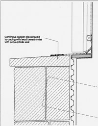
[7/6/09] A new planning application 09/01816/LBA has been raised. It was (according to the council's website information) validated on the day it was received. It is a pity that insufficient care was taken examining it, because there are errors and inaccuracies in the application which render it invalid. The question Do the proposed works include alterations to a listed building? is answered No yet the drawings show that flashing will be inserted into the wall and the design and access statement makes it clear that there are proposals to remove and reverse the coping stones on a wall that the applicants obviously accept is listed because they have raised a Listed Building application.
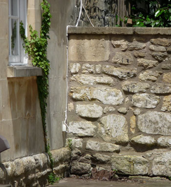 They refer to it as "curtilage listed" as though that is a lower grade of listing, but the Planning (Listed Buildings and Conservation Areas) Act makes no reference to such a category: Section 1-(1)(5)(a) of the act make it clear that this wall is a listed building. The applicant has also claimed in Certificate B that the owner of the listed wall is Old Orchard (Bath) Management Ltd but then they quote the wrong business address for them. The Design and Access Statement refers to the wall as being of recent construction, yet it is clearly marked on the 1902 map that Watchdog examined; we haven't checked anything earlier so we can't suggest its actual age, but even 1902 isn't "recent" by any stretch of the imagination. The cottages side of the wall (pictured) has been recently maintained, but the other side (which is difficult to photograph because of intervening vegetation) clearly shows its considerable age.
So the planning application is inaccurate and therefore invalid and should be cancelled or withdrawn, but in case the Case Officer does not examine it in the detail we have, we will also be objecting. As far as what is planned is concerned, there is no obvious difference between this application and 09/00941/LBA which was withdrawn, and both of the listed building applications show a different roof plan and ground floor plan from that given permission in 08/01040/FUL, so we wonder whether the applicants are trying to sneak in some design amendments in the hope that nobody will notice. Clearly they don't realise that if the drawings don't match, they will have enforcement problems whatever they build because one or other of the planning applications will show that the structure erected is wrong.
While we were comparing documents, we looked again at the set that led to the granting of permission for 08/01040/FUL. We cannot blame the case officer for not considering the impact the development might have on the listed wall, because having sought the advice of a Heritage Officer, the only advice given was that the development would not harm the Conservation Area. We believe that was wrong advice, but again we recognise that the case officer was not in a position to challenge the advice given. But when we looked thorough the complete set of documentation, we find that there is a warning from a local resident that the wall is listed, so when the Heritage Officer failed to comment on the impact of the development on the listed structure, we have no way of knowing whether this was a deliberate dereliction of duty in order to get the carbuncle in the Conservation Area approved, or whether it was just slipshod negligence. Either way, the blame for the current confusion rests jointly with the applicant of 08/01040/FUL when they assumed without checking that they owned half the party wall, and the Heritage Officer who should have alerted them to the fact that it wasn't just any wall but a listed structure, but failed to do so.
All our concerns at the earlier application remain: that without a proper historic survey, the relationship between the (historic, not recent) wall and the existing workshop buildings cannot be established and that the removal of the steel beam could remove the support the wall currently enjoys; that the insertion of lead flashing will cause catastrophic frost damage to the listed structure; and that the tanking of one side to the depth proposed will ultimately cause the wall to waterlog and collapse, at which point, demolition of the new Stoneworks buildings might be necessary in order to rebuild the wall. Without such a survey, any decision other than refusal of permission could be pursued as maladministration by the owners of the wall when the inevitable damage to the wall results.
 [31/5/09] Watchdog has been supplied with copies of recent correspondence. One set claimed that the papers required by law for any proposals affecting a party wall had not been properly prepared nor served. This correspondence was swiftly followed by the withdrawal of planning application 09/00941/LBA on 18th May 2009.
The second set of correspondence covers the attempts by Old Orchard (Bath) Management Ltd to establish the status of the wall between the Old Orchard car park and the Stoneworks development site. A meeting with the Historic Environment Team has been requested, with a view to agreeing the age and status of the party wall, but no arrangements for a meeting have yet been made. Watchdog's opinion is that there is sufficient evidence that the wall meets all the criteria for "Curtilage Listed" according to the definition in PPG15, for such an agreement to be reached.
[5/4/09] Not content with obtaining planning permission for buildings completely unsuited for this part of the conservation area, the developer of the Stoneworks site now wants to make changes to the listed wall separating the site from the Old Orchard parking area. The planning documents for 09/00941/LBA pretend that they are taking action that will be beneficial to the wall, but that is not the case.
Amongst the information provided is a sketch showing the coping stone on the top of the wall reversed so that the slope faces towards Old Orchard, thus throwing far more water in that direction that the current arrangements. No assessment of whether the current drainage could cope with the extra water was made, nor whether any excess of the current drainage capacity could affect the wall foundations or the Old Orchard listed dwellings.
Even worse is the plan to embed lead flashing into the coping stone, entering vertically. One thing that lead flashing should never do is make a vertical entry, because water can penetrate alongside and if it freezes, it will gradually crack the coping stone. So this arrangement is guaranteed to damage the wall, it is only a matter of how long that takes.
There is some doubt about the removal of the steel beam into the existing building too. The explanation is that the beam allows the wall to support the existing building, but looking at the angle of that beam, it is far more likely that the beam is supporting the wall. That wall is a retaining wall for the car park, and the car park surface is far higher than the corresponding surface on the other side, and a beam at that angle would prevent the pressure from the car park side causing the wall to fall.
We think that the planning application proposes a development that will ultimately cause the destruction of the listed wall. The developer has been too greedy, using as much of the land as possible, right up to the wall, and their architect, enthusiastic about modern materials and building techniques, seems to have little understanding about how Bath stone behaves as a structural material. Put the two together and you have a recipe for disaster.
We can only hope that the case officer recognises this.
Go back to top index
Rockery Tea Gardens
[8/11/09] Despite a number of objections from current and past local councillors who represent or live in the area, on 28th October the DCC voted unanimously to permit this eyesore, which will now be granted permission once the Case Officer has reached an S106 agreement. Once again, out-of-city councillors have favoured an out-of-city developer above the concerns of local residents and their elected representatives. Once again, housing targets and a mistaken idea of what constitutes sustainability has triumphed over preserving the character of a Conservation area.
Not only have the owners of the site got their planning permission, but the council by so doing has agreed to remove some much valued on-street parking, to the detriment of local residents. Currently the parked cars slow down traffic, so in future crossing the road to go to and from Rainbow Woods is going to be more dangerous.
The sad thing is that if the buildings had been designed and constructed to match the methods typical of the area instead of all the modern gimmickry, the buildings would not only be almost as environmentally friendly on a day to day basis, they would last at least four times as long, with a resultant much lower total carbon footprint. The sedum roof is not a fit and forget feature and nor is cedar cladding. These are high maintenance features which will probably be allowed to deteriorate over time. Another bad decision that we shall take "I told you so" photographs of when it is built.
The sadder thing is that the National Trust wanted to buy the site and turn it into an information centre, a refreshments area and a transport interchange and car park for the Bath Skyline Walk, Rainbow Woods, and Prior Park Gardens. We have a letter from the National Trust informing us that they approached the site owners along these lines but the owners of the site had refused to discuss anything with the National Trust because they hoped to secure planning permission for housing. Refusal of permission (and we believe that a refusal on the grounds of over-development on a transitional site between urban and rural, plus a desire to maintain the character of the Conservation Area, would have been upheld on appeal) would have kept the National Trust's ambitions alive.
[6/9/09] New drawings have been lodged at the end of August 2009, which change the appearance and location of the garages. The aim seems to be to improve the view of the site from the outside, and as far as the garages are concerned, it is a slight improvement. What it doesn't do though is alter the appearance of the dwellings, which still look completely wrong for that location.
However, it has been known for a case officer to ignore earlier comments after new drawings have been submitted. We don't know whether that would happen for this planning application, but to be absolutely safe we recommend that anybody who has previously commented on this application should comment again, to eliminate all risk.
 [21/9/08]
The Rockery Tea Gardens have been unoccupied for a while, and now there is a planning application 08/03370/FUL for building two houses and 9 apartments after demolishing the existing buildings. We need to study the documents, which only appeared on 17 September before reaching a view, but first impressions are that the design of the three apartment blocks are out of character, both in size and design compared to the other buildings in the area.
[21/9/08]
The Rockery Tea Gardens have been unoccupied for a while, and now there is a planning application 08/03370/FUL for building two houses and 9 apartments after demolishing the existing buildings. We need to study the documents, which only appeared on 17 September before reaching a view, but first impressions are that the design of the three apartment blocks are out of character, both in size and design compared to the other buildings in the area.
They also seem to be very close to the neighbouring residences which are of much more conventional appearance, and this picture is what those neighbours would look out on. It is a mess of different colours, finishes and shapes.
Comments can be made either on-line or in writing to the planning office.
Go back to top index
Sawclose
November 2015 Update
On 31 October 2015 the Sawclose site was opened to the public for four hours, giving those who went in an opportunity to look at what the archaeological exploration of the site had found so far, and to speak to the archaeologists about what was on show. There were also some of the pieces found, on tables. These included Roman pottery fragments, Medieval fragments and Victorian pieces, including one unbroken jar. There were explanatory sheets of these findings, but most visitors thought it was quicker to ask the archaeologist manning the table.
 On another table was a display of around 100 bowls from clay pipes, all with short pieces of stem attached (we were told that this was only a small sample of the total found) and a few larger though still incomplete pipes like this one pictured. There would have been a green varnished tip on the end of the pipe, to prevent the clay sticking to the smoker's lips. The archaeologist told us that they believed they had found the factory's rubbish heap for rejects, because there were no unbroken pipes unearthed. The rejects would have been inconsequential in business terms because the unbroken pipes sold at a retail price of six for a penny, and those buying them would typically use them once and throw them away.
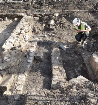 Only about half of the total area to be excavated had been explored so far, and the archaeological exploration would continue until February 2016. Even so, there was plenty for the public to see.
This picture shows a dwelling, identified from old maps as No.9 Bridewell Lane. The structure in the foreground seems to be a staircase arrangement, with the stairs up from the basement on the left as viewed in this photo, and the stairs up to the upper storey being on the right. The position of the newel post has been identified, which supports this arrangement. The stairs would have been wooden, so the stairs themselves are unlikely to have survived.
Behind the archaeologist and off the side of the photograph is a structure that has had an an initial guess that it may be the toilet, but this has not yet been excavated properly to positively identify what it is. Only a few artefacts have been unearthed so far and these have all been of a domestic nature, so it appears that this building was purely a residence and has no connection with the pipe factory next door.
The archaeological excavation will continue down to the depth of the foundations of the development to be constructed on the site, and it is known that there are Roman finds under both Bluecoat House and the Mineral Water Hospital so it is thought very likely that Roman archaeology will be found under the Sawclose too.
The most remarkable find was unearthed when exploration of No.10 Bridewell Lane took place. What probably started as a dwelling had been converted into a clay pipe factory, and a lot of it had survived.
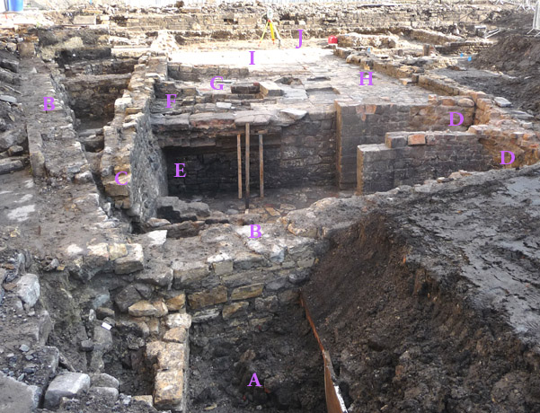 It is thought that it was the proximity of Bluecoat School that saved it. After the factory had been operating for some time, it occurred to the council that a factory permanently emitting copious amounts of smoke from its furnaces was not an ideal companion to a school and a hospital, and the factory was forced to close. The owners moved the production to Milk Street and Bluecoat School only wanted to use the area for a school playground, so anything under that level was left undisturbed. The bonus for the archaeologists is that the original flooring was still in place, a rare find for them from times when materials from one unwanted building were usually scavenged to use in constructing another.
This picture shows the clay pipe factory as seen from the rear, with Bridewell Lane in the distance. Some identifying letters have been superimposed on the photo. Starting at the Bridewell Lane end, "J" is the front office, where orders were taken, accounts maintained and all the functions connected with the customer took place. There would have been a staircase up from there and the owner would have lived above the office.
The first production space is identified as "I". This was the area where clay was prepared and placed in the moulds to be shaped. Once removed from the moulds the batch would be taken down Corridor "H" and into the finishing room "G" where any rough edges from the moulding process were trimmed off. From there the pipes would be taken up staircase "F" to a drying room above, where the excess moisture would evaporate over a period of 3 days so that they would hold their shape when fired. Firing took place in a container known as a "muffle" which was heated in a furnace and kept the pipes away from the flames and soot of the furnace. It took a day for the furnace to heat up and fire the clay using coal stored in areas "E", and a day for the furnace to cool down afterwards, so two furnaces, "D" in the picture, one heating and one cooling at any given time allowed a 24-hour production cycle. Once cooled, the pipes were packed and shipped. There is a 3D image of the furnace area on the Cotswold Archaeology website.
The remainder of the identified structures in the photo show the level of detective work the archaeologists are faced with. The wall "C" which runs parallel with passage "H" is the boundary wall of the factory and gives it a rectangular shape. But the walls "B" demolish the far end of wall "C" and is of a later building, not yet identified or dated. Excavation has now started on area A which also has a side wall parallel with the factory wall; so far nothing has been found which gives any hint at what this location might have been. The dig will continue. Whether the public will be allowed another look remains to be seen.
This is what we said on 9 March 2014.
The Development Control Committee considered the applications for the Sawclose development (13/04234/EFUL and 13/04218/LBA) on 12 February 2014, and decided to defer a decision in the hope of further improvements to the design. Some design changes were made, and the scheme is back before the DCC on 12 March.
There are some improvements in that some of the chosen materials that would have sat uncomfortably in Bath have been changed. Some changes to soften the design have made a small improvement, but these unfortunately throw greater emphasis on the stark boxiness of the hotel roofline. Whilst there could have been a role for contemporary architecture in this location (for example the Seven Dials development opposite is an example of elegant contemporary), the buildings around it should have been a clear indication that harsh rectangles would never be a comfortable fit. Yet that is what is proposed. One member described the latest improvements to an over-stark design as being akin to putting lipstick on a pig; it remains a pig. We still think there is scope for this development became the first ever Carbuncle Cup nomination within a World Heritage Site; and the ultimate irony if it won!
The reports provided to the DCC Members are an improvement on the previous attempt in that it does mention some of the things that were previously omitted. The concerns over disabled parking are recognised, though the suggestion that it can be left until Phase 2 to decide how to handle the loss that arises at the start of Phase 1 still leaves the development in clear breach of the Equalities Act. There is greater recognition of the several comments which criticise the design, but there is no mention of what parts of the design result in such criticisms, so the Committee is left in ignorance of what parts of the design they should look closely at. Watchdog complained about the roofline of the hotel not being in keeping with the area and the boxy appearance of the casino contrasting badly with the softer lines of the adjacent retained structures, but these criticisms did not feature in the report. The planning legislation requires decision-makers to pay special attention to certain aspects of an application, and if the DCC members are not given the information about which they must pay special attention, they cannot ensure that they make a decision that complies with the law.
Similarly the loss of listed structures are "considered acceptable" in the report, yet the English Heritage advice on listed buildings is that the history as well as the architecture should be considered important, and in that respect the loss of the Weigh House just to make a bit of open space (which will no doubt be replaced by tacky tables and chairs eventually) fails to recognise that its presence is important and it should not be described as being of "less than significant value". It could and should remain in situ, particularly when it is positioned on a Scheduled Ancient Monument. Inadequate justification for the rest of the demolitions also fails to meet the expectation in the legislation that special attention (which translates as a presumption to retain unless there are overwhelming reasons not to) should be paid to the desirability of retaining historic features.
Planning applications should be evaluated against a different Act to listed building applications, and our examination of both suggests that although the planning permission could be given, the listed building application should be refused. Nothing in the Committee Update Report leads Members to that conclusion however. Both permissions were granted in May 2014.
Go back to top index
Somerset Buildings
[5/10/08] This application is to demolish the current TR Hayes building in front of Hedgemead Park and to replace it with a larger two storey building. The entire existing building is to be demolished. As this is within a Conservation Area we are assuming that CAC will be necessary, though no application has appeared so far. The resulting building will be a showroom for products, but nothing will be sold from there, so there are no concerns about delivery traffic, or customer parking which will continue to be provided by the shop on the opposite side of the road.
The design of the new building is in keeping with the surroundings, and apart from some concerns about the central gully of the roof being likely to block with leaves and therefore there should be an access hatch to the roof to enable easy clearance, but none is proposed, Watchdog has no real concerns about the appearance of the building.
But we are concerned about the construction. The proposed building is sited within the environs of Hedgemead Park which is on English Heritage's Register of Historic Parks & Gardens. The rear boundary of the site meets the boundary of the Grade II listed Gloster Villas.
The site was the location of Gloucester Inn, which occupied this site from 1792, and by the mid 1800s a brewery had been constructed behind, including the vaults which are still in existence. In 1876 organ builder James Clark became the owner of the Gloucester Inn and conducted his organ building business from the site until 1894. The records show that organ builders Griffen & Stroud had their premises behind from 1895, and the continuity of dates suggests that they continued in James Clark's building. That building was over the original brewery vaults.
The Gloucester Inn burnt down on Sunday 1st December 1901 and was subsequently demolished. The organ factory survived but was seriously damaged by water. A new building (a car showroom) was built on the site of the Gloucester Inn, but there are no records of what happened to the organ factory, though its (presumably derelict) walls were still showing on the 1936 maps.
We believe that the historic vaults and the north western boundary wall, and its features, should be retained and incorporated into the plans. They are the only remaining historical part of the site, which has a long history, besides Gloster Villas, and represent a large piece of Walcot's history. We are also concerned about the stability of the site if the vaults are removed. They are substantially built, and that solidity might explain why the Gloucester Inn and Gloster Villas survived the landslips that destroyed the surrounding buildings. It should be possible to construct on the top of the vaults, as the organ factory did, and with suitable waterproofing, the brewery vaults could perhaps be usable space.
Comments can be made on-line or in writing to Trimbridge House.
Go back to top index
Theatre Royal
 When we commented on the plans for the Theatre Royal, we were supportive of the work inside the building (and even suggested a few minor improvements), but had a few reservations about the exterior work.
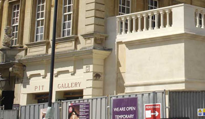 One of the suggestions we made was that the words "THEATRE ROYAL" that was on the outside of the original box office extension (see picture above) should be retained and remounted on the newly constructed wall facing south, advertising the building to those approaching from Westgate Buildings and Westgate Street. We appreciate that work is still in progress, but there is no suggestion in the revised drawings that the former sign is to be installed. As you can see from the photograph, this omission makes it look as though the building is called "PIT GALLERY". We recommend that signage with the theatre name is added.
We appreciated the opportunity to discuss the proposed improvements to the Theatre Royal with the Theatre management and the architects, so we were disappointed to discover that revised drawings were lodged without letting us know, particularly when we had indicated that we could offer some constructive ideas when the external lighting scheme was being designed. However, a lighting scheme was put forward in the new drawings and approved as submitted. With the holes drilled and the cables run, we accept that there is no opportunity to influence the lighting scheme now, and can only wait to see what it looks like when everything is finished.
The element in the plans that most concerned us was the proposed canopy. We thought that the size proposed would make eventual damage from a traffic accident inevitable. The good news is that the size has been reduced in the later drawings.
 We were aware that the canopy would be in metal, but we were under the impression that it would be painted metal. Indeed the revised drawing showed that the canopy would be either copper or pre-patinated (= artificially oxidised) alloy depending on what was approved. We had recommended that the top of the canopy should be glass (rather like the canopy in front of Green Park Station), so that the Royal Coat of Arms would be visible and able to be photographed from in front of the theatre without standing in the street and risking a traffic accident. We can see, now that the hoardings have been removed, that the suggestion of glass fell on deaf ears.
 The juxtaposition of the construction company's banner over a shiny gold coloured canopy was amusing to those who knew the story of King Midas turning everything he touched to gold (or in this case polished brass).
 However, standing back and looking at a Grade II* listed building with a Georgian main house fronted by a Victorian box office, a shiny brass canopy really looks out of place. It is the architectural equivalent of a pantomime dame bounding on stage in the middle of a scene from Hamlet and throwing sweets into the audience. A pantomime dame has a place, but it is not there! Likewise, we cannot understand the choice of shiny metal over elegant Victorian arched doorways when the option of a pre-patinated finish was available.
 Given its unfinished and unpolished state, we were surprised by the quality of the reflection, which is even clearer than our picture on the left suggests. Future female theatre patrons with low-cut necklines will never be able to be entirely sure whether anybody giving an admiring glance upwards is appreciating the canopy itself or the reflection in it.
 Such criticisms aside, we are still supportive of the interior work, and were grateful for the glimpses of the inside shown on the TV. These three snapshots from the TV screen give some idea of the work in progress.
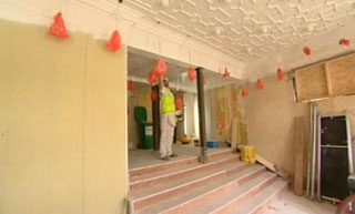
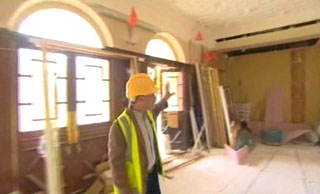
Go back to top index
Wells Road at rear of 54-56
[10/5/09] On 22 April 2009, planning permission was refused. The reasons given were sound: that the size of the building would be an over-development of the site leaving very little outdoor amenity space; that the building would be overhung by trees that were important in the views of the area and worthy of Tree Protection Orders, reducing natural light to unacceptable levels; that the building would overlook its neighbours in an unacceptable manner.
Interestingly though, there was no mention of the other drawbacks: that providing electricity, water and sewage services to the site would damage the root area of the valuable trees; that the design of the building would be alien to the conservation area and affect the environs of a listed building; that the lack of vehicular access would make the attendance by emergency vehicles to anybody living there impossible, and that anybody moving in would have to have their furniture carried in from far away, and rubbish collection would also entail a long walk.
We also believe that any attempt to build in this location would cause additional structural damage to the listed 54 Wells Road, because although there is planning permission to stabilise the building and add a rear extension, the owners of the building are trying to sell it with that planning permission, rather than build what they have planning permission for.
[4/5/08] There was a planning application 08/01096/FUL for a modern prefabricated building in the currently derelict land behind 54 Wells Road. While researching this one, we found two other planning applications 07/01129/LBA and 07/01132/FUL to build an extension on the back of 54 Wells Road and convert it into 8 flats, which have now been granted permission.
Now the reason given for the extension on the listed 54 Wells Road was to stabilise the building because it is showing signs of structural decay. So we wonder about the wisdom of inflicting on it the inevitable vibration from the machinery necessary to build something at the bottom of its garden.
We think the prefabricated building will look alien in this location, where Bath stone (either real or imitation) is the norm, and we wonder about the wisdom of a house on a site so cramped that there are only inches from a boundary wall, which will make maintenance impossible, yet provide a space where seeds dropped by birds or blown in the wind can germinate into trees or brambles which will be impossible to grub out. There are other impracticalities too. How the emergency services are expected to deal with any resident's emergency is not explained. How the rubbish and recycling collections are meant to collect and where from is not explained. How any resident is going to unload furniture to move in is not explained. We objected to the prefabricated building for all these reasons.
But the real reason why the application should have been refused is because the plot was part of the conditions for permission granted to construct the nearby student residences; It was required to be made into a garden in perpetuity. When a Case Officer under delegated authority overrides the express wish of a planning committee for a specific use for the land, something is very wrong.
We understand one of the neighbours has raised a formal complaint because of this.
Go back to top index
Walcot Street Cornmarket
As much as we would like to see the Cornmarket restored and given a new lease of life, we have some serious concerns about the application 09/01138/FUL which has just been submitted. Despite all the future ideas described in The Chronicle, the application is for a much smaller scheme.
According to the documentation submitted, a decision is requested on a change of use for the building, with information on the work to be undertaken on the building and the use to which it is to be put to be provided at a later date. This is a very odd sequence of events.
The use classes applied for are very wide in scope:
A3 - for the supply of food to be consumed on the premises, or hot food to be consumed off the premises.
B1 - for offices other than those where services are provided for visiting members of the public or for research and development or for any industrial process suitable for a residential area. Although the application form has shown "Not Applicable" for light industrial use, the category B1 automatically includes it unless specifically excluded by conditions.
D1 - for any use not including residential use, which can include health services, childcare, schools, museums, churches and the like. Effectively this covers anything the public might attend except shops, offices, houses and hotels.
In effect, the planning application requests to use the building for anything except residential and retail. It does this in advance of any information on how the fragile building will be stabilised and restored, how the inside might need to be sub-divided, and what it is actually going to be used for. It is like asking your bank manager for a loan on the understanding that you will tell him at a later date what you want it for, and the application must be refused for reasons of insufficient information. In the unlikely event that permission is granted, the current state of the building will prevent it from being used for anything, so the application is not only premature, it is pointless until a Listed Building application has been granted consent and the work it describes is completed.
Also, the documentation is inadequate. There is a separate (and much older) listed structure ("Riverside Building" in the English Heritage records) which is located alongside and partially below the Cornmarket. Without a proper historic survey, it is impossible to tell whether the applicants know that it is there, and whether the change of use might have any impact on it, but its absence from the list of neighbouring properties suggests that its presence will come as a surprise. The Planning Statement mentions underpinning, which might be problematic if such work would damage the Riverside Building or affect its stability.
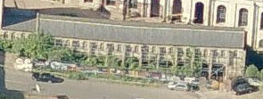 Our restoration advisors estimate that the cost of stabilising and restoring the Cornmarket from its current state is very likely to exceed the market value of the building once it is restored. There is also a real risk that when restoration work starts, the building might collapse completely, so any restoration work permitted has to be on condition that the eventual outcome must be the building restored as was within a finite defined time, regardless of any discoveries or eventualities during the work. This means that anybody taking on the restoration has to have sufficient funds to complete the work and have a long term plan to gain an income from the restored building sufficient to eventually recover their expenditure. The alternative, that somebody would donate the excess cost just for the pleasure of seeing the building restored is possible, but is considered highly unlikely in the current financial climate. We are therefore rather concerned about the comment in the Planning Statement "once viable uses have been established" which suggests that there are no long term plans and the restoration would be taken as something of a gamble.
We therefore examined the application form in detail to see whether there are any clues about intentions, and whether the applicants have any track record indicating any probable outcome. And that is when we spotted a number of very worrying anomalies.
The applicants are listed as Sires Property of Bailbrook Lane. A check with Companies House reveals that Sires Property Development Ltd of Bailbrook Lane was dissolved on 28 August 2006. There is a company called Sires Property Development Ltd of Brunswick Square, Bristol which came into being on 27 March 2009. Neither of these have lodged accounts, or even a description of company activities, with Companies House. The applicant may be a bona fides business, but there is no publicly filed evidence that they have the resources necessary for the scale of expenditure that the Cornmarket is going to demand of them.
Further down the Application Form it states that advice was sought from a council officer on 5 March 2009. That planning officer was named as the case officer the first time Watchdog examined the planning application, but at the time of writing this, the case officer has been changed to another. This leads us to speculate on why the box describing the pre-application advice received is left blank. Did the officer really offer no advice? Or was the advice unwelcome as far as the applicant was concerned and they chose not to reveal it while requesting a different case officer in the hope of securing a different interpretation of planning policy when the application is evaluated?
The date the pre-application advice was sought is also worrying. It is two and a half years after the first Sires Property was wound up, and three weeks before the second one came into existence. So who actually asked for pre-application advice on 5 March?
The other anomaly on the form is that the owner of the site is B&NES, which is correct, but if the planning authority wishes to make a site visit then it has to apply to the applicant. Why does B&NES need to ask the applicant to visit a property that B&NES owns? Has the local authority surrendered the keys already? If they have, then has the council ensured that they have no residual Health and Safety responsibility if the applicant enters the building?
 And under what arrangements were the keys handed over? As we explain above, there is a second listed structure (pictured right) in the vicinity of the Cornmarket which will make the stabilisation very tricky, there is no profit to be made from a quick sale after restoration, and the applicants are not known to have sufficient assets to complete the repairs when they openly state that they have no firm plans for securing a long term income from the building to offset their expenditure. So we wonder: has the council taken a massive gamble with the future of the Cornmarket, and what other bids did they discard? And if there were other bids, why was there no public consultation?
There is so much that is odd about this planning application that Watchdog believes that the council has a conflict of interest, being both the owner of the property and the planning authority. There are too many oddities about this application for us to be convinced that due process was correctly followed. It is evident therefore that the application should be refused, or else the decision should be made by the Secretary of State and not by the case officer or the DCC.
Go back to top index
Other News
Cleveland Pools
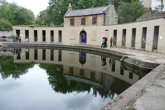 As part of Heritage Open Days 2010, one of the places Watchdog went to visit was Cleveland Pools, and we were lucky enough to speak to a member of the Trust and one of their architects. We also overheard conversations from other visiting members of the public recounting what they remember of the pool facilities when they swam there, which must have been valuable background for those trying to interpret what is currently there.
The thing that stood out very clearly, reading between the lines of the exhibits for the public to read, is that the council is the current owner of the site, which was in a good enough condition to permit public bathing as recently as 1985. So the dereliction that can now be seen, the leaky roofs, the damaged walls and paving etc (there were numerous signs warning of dangerous structures on the Open Days) can only be the result of the owner's neglect. A tarpaulin might not look attractive, but it would at least have stopped the timbers under the hole in the roof rotting, for example.
Some English Heritage money has been recently secured, which will allow an investigation of the current structures, will permit some emergency repairs, and will fund an Options Study which will advise just what is required to bring the pools into public use and exactly what facilities that will provide.
This is a Grade II* listed site, and one which according to the UNESCO Mission is at least as important historically as the Georgian heart of Bath. Also, given its position and its listed status it is almost impossible to identify a use for it that will be acceptable under PPS25 apart from a public lido. A fish farm has been tried and it did not survive as a sustainable business for very long.
Thus although there may be some flexibility about what facilities go where and what they are used for, the Cleveland Pools Trust currently provides the only viable way of rescuing the site from dereliction. So why, we wonder, are the council sitting back asking awkward questions when they should be actively assisting the Trust to get the pools back into use as soon as possible. After all, if the council makes life too difficult, the Trust could walk away, and then the cost of preserving the site from further dereliction would have to be council funded, so co-operation in the form of a Conservation Officer's time, can be easily justified as a "Spend to Save" measure.
Just before the Open Days, the main pool was drained (photos were on display). Under the mud at the bottom was a concrete surface, when the historical research shows that it should be paving. The curved side of the pool is the original Bath stone, at least down as far as the concrete floor, but the other side parallel with the river is constructed of engineering brick under the normal water level. Obviously like for like repairs have not taken place in the past, and the council has either condoned or failed to enforce these inappropriate materials.
One piece of good news is that draining the pool revealed that there is a natural cold spring that feeds the pool, so there has been no problems associated with stagnant water despite years of disuse.
We left our contact details with the architect, and we would be happy to discuss with them their options conclusions if they wish to do so. They expressed a preference for the restored pools to be a fun and leisure destination rather than a preferred alternative for serious swimming, and we think that is a good choice to obtain the necessary footfall.
The Chronicle published an article outlining the progress towards restoring and reopening the Cleveland Pools as a lead-in to the Heritage Open Days. We were pleased about this news, and suggested that those who share our interest read the website maintained by the Cleveland Pools Trust, or go along to talk to the Trust members during Heritage Open Days because this is the only time the general public can get a sight of Cleveland Pools.
In 2011 we were concerned about the condition the rare Georgian gem had fallen into, so we have made comparisons with previous years and bring you this photo montage of dilapidation.
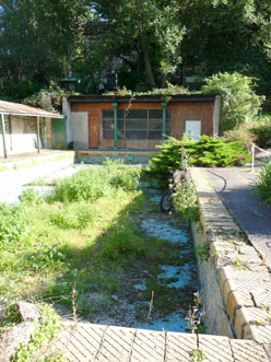
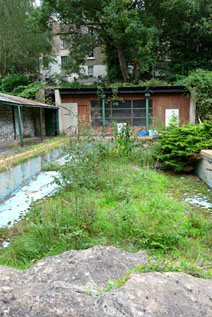
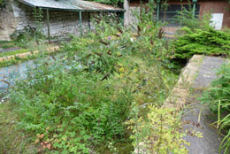
These pictures, with 2009 on the far left, 2010 in the middle and 2011 on the right, were not quite taken from the same place because the areas roped off for public safety vary slightly each year.
However the fact that the weeds are being allowed to grow unchecked is obvious, and some plants, particularly the buddleia and the ash tree seedlings seen for the first time in 2011, have destructive roots. An annual dose of weedkiller would not be expensive, and could save a lot of expense on walkway repairs at a later date.
 Other paving damage can be seen in 2011 on the areas around the main pool, pictured left. Before being cut back for the Open Days, weeds had got established and had made the paving uneven.
There are no comparable pictures from previous years because the paving then was in good enough condition that nobody thought it worth photographing.
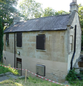
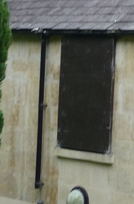 The next area of concern is the dwelling house, which not very long ago have somebody in residence which kept the building in good condition. Sadly, its use as a residence was discontinued and the building has deteriorated.
The two points of interest in the 2009 picture on the right (by then uninhabited) are the downpipe from the gutter and the area of blistered paint on the bottom right hand corner of the building, and a later picture shows that area enlarged.
In 2011 a part of the downpipe is missing, as can be seen in the picture on the left, allowing the rainwater to soak the walls whenever it rains.
In 2009 (pictured left) there were the first signs of damp getting under the blistered paint, but a small amount of effort then would have protected the building from further damage. That did not happen though and as the 2011 picture on the right shows, weeds have rooted in the stone, the corner has got damp enough to gain a growth of moss and algae and the bottom course of stones has started to fracture. Repairs now will be more expensive.
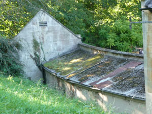
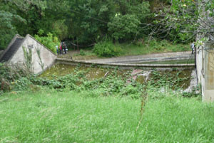 In 2009 the roof of the changing room block was not in good condition (see picture left), but the covering was only moss which is not particularly damaging to something that does not look like original fabric.
In 2011, there was more moss, but that moss was now dense enough to allow other plants to grow, and ivy and brambles can be seen in the photo on the right. These can be damaging, not to the roof itself, but to the cubicles beneath it.
 The next area to be examined are inside those cubicles, where the comparison can be made between the very beginning of weed growth in 2009 pictured left, and a significant infestation in the 2011 photograph on the right, some of which appears to be ivy which has grown down inside from the growth on the roof. Ivy roots can cause considerable damage to Bath stone if left unchecked and the rear walls to the cubicles do look as though they could be original Georgian fabric.
Although negotiations continue between The Cleveland Pools Trust and the council with a view to bringing the pools back into use, and the Trust is reasonably optimistic about obtaining a Lottery grant towards the cost, the reality is that right now the pools are owned by the council, and the council has allowed the unacceptable level of dereliction that we now see.
This is the oldest surviving Georgian outdoor bathing facility in the country and its listing at Grade II* emphasises their importance as a national treasure (the full text of the listing is here). The fact that it has got into its current state because of council neglect ought to lead to the council imposing on itself a Dilapidation Order to prevent further damage to the historic fabric, but we doubt that they will.
Watchdog discussed the condition of the Cleveland Pools with the UNESCO Mission when it visited Bath in 2008. They were surprised and disappointed that such a rare example of a Georgian lido had been allowed to deteriorate into the state our photographs from that year showed, especially when it is owned by the council. However, because the pools were not part of their itinerary and they did not see them for themselves, the opinions they expressed to us did not appear in their formal report. Nevertheless we know that the Pools are regarded by UNESCO as a Georgian gem and they will want to be informed when the current period of neglect comes to an end.
Watchdog took advantage of the Heritage Open Days of 2013 to visit Cleveland Pools again to view the changes since our last visit two years before, and to talk to the Trustees who were present.
Before our visit, we had reported in July the Chronicle item about an initiative to raise funds for the restoration which was soon to be launched. The activities of the Trust since then have been aimed at increasing public awareness. The Chronicle reported a Children's Art Event held in the Central library and included information on the fundraising aims. The art exhibits, some from very young children, can now be viewed online. The fundraising ambition has also reached the national press: we found an article in The Guardian.
Despite heavy persistent rain on the day of our visit, there were a number of adults and parents with children exploring the site, and we concluded that the future of the Pools was important enough to the community to brave the elements with anoraks and umbrellas in order to see the current state and discuss the future plans. We were also agreeably surprised at the improvements that had been made since our 2011 visit.
 We noted that thanks to a grant from English Heritage the actions necessary to prevent further deterioration had been made possible.
The changing rooms previously open to the rain through damaged roofs allowing damaging weeds to grow inside the cubicles as well as through and on the roofs (left) were now dry inside and weed free thanks to some effective temporary roofing (right).
 We noted the small pool, previously a mess of weeds, rubbish and self-planted shrubs (left) was almost clear and just a small amount of leaf litter remained (right).
We noted that the damaged and missing roof slates on the cottage had been repaired, as had the missing section of drainpipe that had caused moss and algae to grow on the wall, which in 2013 was clear of such growth. With he cottage roof repaired, the other visible signs of damp walls had also gone.
The council had addressed the safety issues on the site. Previously wobbly steps were now fixed in place. Safety railings had been installed where previously they were damaged or missing, The rubbish that had blocked the use of the Ladies Pool area and a part of the cottage had been removed, and floorboards had been repositioned inside the cottage.
 All this allowed the 2013 Open Days to offer visitors a look round the Ladies Pool building and the inside of the Cottage (right) for the first time. The council had also arranged for a water supply to the site to be restored, so for the first time the visitors to the site had working toilets, even if they had to be lit by candles because there is no electricity.
The Trustees explained that the council had also granted a temporary lease which allowed the Trustees rather than the council to control access to the site, which had made it very much easier to coordinate the maintenance of the grounds and keep the weeded parts weed free and the grass under control.
With the coming darker evenings when the clocks go back an hour, a portable generator is top of the current wish list. A 4Kw or greater generator would provide power for lights and also allow a small amount of water to be heated so that the volunteers who currently work there in the evenings after returning from their place of employment could continue to do so during the dark winter evenings and then wash their hands before leaving. The Trustees are currently investigating whether a generator could be provided on loan or as a donation, and we are happy to publicise the need here in case anybody reading this can help. There is a contact form on the Cleveland Pools website.
Despite this good news, there are still problems to be addressed. The main one is the future funding. When a bid based on the recent Feasibility Study was submitted to the Heritage Lottery Fund it was well received and it was described as one worthy of support, except that the evaluation process was looking for a commitment from the landowner (the council) and there was none in the bid. Similarly English Heritage had provided emergency funding to halt the deterioration of the heritage assets but have said they are unlikely to provide any further funding until there was a commitment from the council as well.
It is appreciated that the council is short of funds, but the Trustees are not looking for anything in the current financial year, merely a future commitment that can be included in the bid so that money might be forthcoming from the Heritage Lottery Fund; and the council thus has time to factor in a contribution to the Cleveland Pools into a future year or spread it over two. We can think of some items of recent expenditure that were only nice to have rather than necessary, and no doubt there will similarly be others in future years, or opportunities to defer scheduled expenditure into another financial year. The Heritage Lottery Fund will not remain well-disposed to the Cleveland Pools application indefinitely, so the council needs to decide fairly soon whether it wants the Pools restored or to remain derelict, and to say which.
In August 2014 we reported that after nearly 10 years of preparation and an agonising wait for the decision, the Cleveland Pools Trust have finally been awarded a grant from the Heritage Lottery Fund to restore the Cleveland Pools. The Chronicle broke the news. We are delighted, though we recognise that the sum granted, although substantial, isn't the whole amount needed and some further fund-raising will be necessary.
 In
September 2014, the Cleveland Pools opened for visitors on three afternoons as part of the city's Hidden Treasures event. As well as the pools themselves and information on their history and future, there were also children's entertainment, artworks, refreshments, treasures and relics from the pools history, and even lessons on using a scythe. We went on the third day, to be counted among the 701 visitors that day, bringing the total for the three days to over 1300 visitors, which is a lot of public interest. We were agreeably surprised to see a group of "Georgian" ladies and gentlemen arrive to inspect the pools while we were there.
In
September 2014, the Cleveland Pools opened for visitors on three afternoons as part of the city's Hidden Treasures event. As well as the pools themselves and information on their history and future, there were also children's entertainment, artworks, refreshments, treasures and relics from the pools history, and even lessons on using a scythe. We went on the third day, to be counted among the 701 visitors that day, bringing the total for the three days to over 1300 visitors, which is a lot of public interest. We were agreeably surprised to see a group of "Georgian" ladies and gentlemen arrive to inspect the pools while we were there.
We discussed the future plans with the Trust's Chairman. We discovered that the Heritage Lottery Fund required reaching agreement in principle to some preliminary issues (for instance the establishment of an accounting system of sufficient rigour to satisfy the HLF's auditors) before any money will be forthcoming. We were also informed that the HLF do not hand over funds in advance, but expect the Trust to meet the staged payment milestones and then claim that expenditure back from the HLF. It is therefore imperative that the council and sponsors should make the promised funds available in good time in order to create the float that will pay the bills which would then be claimed back from the HLF to fund the next stage.
Once the preliminary activities are completed and access to the promised funding is assured, the Trustees intend to appoint a Project Manager to prepare the detailed stage plans and to oversee their delivery. As well as the proposals to restore the pools, there are some planning preliminaries, because although the site was a functional swimming pool in the past, it did get permission for a change of use to become a Trout Farm, so it needs another planning consent to revert back to a site for bathing. Also it is a Grade II* listed building, so Listed Building Consent for any physical changes will have to be sought and obtained.
Until the Project Manager has established an achievable timescale, only assumptions can be made at this stage. One assumption is that 2015, being the 200th anniversary of the first opening of the pools will be of necessity mostly spent on planning and administration rather than restoration work proper, and that will give the Trustees the opportunity to organise some 200th Anniversary Events during 2015.
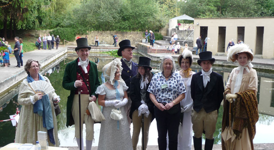 This anniversary would hopefully bring publicity and fund-raising opportunities (crowd funding was mentioned as one possibility: and our research showed that The Medway Queen Preservation Society has taken such an approach for the preservation of the historic ship, proving that there are backers prepared to invest in restoration projects). An easy early win would be improved landing facilities for river craft, making that route a viable alternative to the current narrow entrance path.
Our chat with the "Georgian" visitors (who were actually in Bath as part of the Jane Austen Festival and had made a detour: they are seen here posing with the Chair of the Trustees) indicated that they might be persuaded to turn up again for appropriately themed events. If they were advertised in advance as being on-site their presence should increase visitor numbers.
The Cleveland Pools website will keep those interested up-to-date with the latest news.
Go back to top index
Frost damage
Water has a unique property in that when it freezes it expands and becomes less dense. In some circumstances that is beneficial: for instance it means that the top surface of a pond freezes first, leaving liquid water beneath for the fish to survive in. But the combination of water and Bath stone is not a happy one if the water freezes.
 Our first picture was taken early in 2010, and shows one of the arches on the Churchill Bridge roundabout. Other parts of the arches along this viaduct were in a similar condition.
 Our next picture is of one of the cottages in the Twerton Viaduct. Note how the moulding framing the doorway has broken away, and the picture below it shows where it fell. These pictures were taken in January 2011
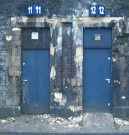 Other cottages along Twerton Arches have also suffered frost damage, as the picture on the right shows. We expressed our concerns to Network Rail, who were sympathetic about the need to restore the appearance of the damaged structures, but pointed out that their funds are limited, and the priority for the maintenance budget was for repairs that ensured safe operation of the railway. Whilst our reported damage looks bad, it is purely cosmetic and does not affect the structural strength of the viaducts. We are assured that the fallen mouldings have been put into safe storage so that they can be used as patterns for replacements, but have not been offered any indication of when repairs might take place.
 Our final picture is of the entrance to the Post Office, opposite the Podium, where a section of moulding has broken off. By the time we noticed this, the area under the damage had been fenced off and the fallen material had been removed.
 One possibility about the cause of the Post Office damage is the buddleia that was growing above the entrance during last summer (see picture right). Buddleia has particularly destructive roots, perfectly capable of prizing stonework apart as they grow. In the autumn this and the other plants elsewhere along this canopy were removed, but we wonder if anybody thought to seal the cracks in which the plants rooted. If not then these would have provided an easy path for water to get behind the moulding, and other parts of the canopy could be at risk, because the pictured buddleia was not the only one growing on the top.
 We have noticed a common theme, in that none of the structures suffering frost damage are heated. An examination of a selection of the houses and shops that are occupied doesn't show any major signs of frost damage. We ask landlords and owners of unoccupied buildings to keep this in mind.
We end on a brighter note: The missing moulding had been replaced by the autumn of 2011, see picture left. The repair is not quite perfect in that the gaps between the new piece and the remaining original mouldings are not quite right. The left hand gap is too narrow and the right hand one too wide. However, when the new piece weathers and becomes less obvious, few will give it a second glance, and fewer still will notice the spacing errors.
2012 Frost damage
February 2012 saw some severely low temperatures coupled with abnormally low humidity. The consequence of this combination was that moisture in porous stone like Bath stone ashlar can damage the stone. During the daytime when temperatures rose above freezing the moisture deep in the stone would tend to migrate towards the low humidity at the outside surface where it could evaporate, and the residual moisture just below the surface would then freeze overnight expanding as it does so and in the worst cases fracturing the stone.
As we observed the previous winter, the greatest risk of damage would be in locations which are unheated, and this year's damage bears this out.
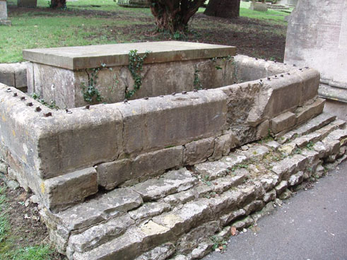 Our first photograph was taken in All Saints Churchyard in Weston and shows the grave of Dr William Oliver. Whilst he might be mostly remembered in Bath as the inventor of the Bath Oliver biscuit, his biographical notes reveals a greater, and probably more important legacy. While practising in Plymouth he promoted the very new treatment of inoculations against smallpox, and later after moving to Bath he founded the Bath General Hospital as it was originally called, though it is now known as the Royal National Hospital for Rheumatic Diseases; and he worked there as physician to the hospital for over 20 years, during which time he invented the Bath Bun and the Oliver Biscuit. He was a friend of Ralph Allen (who donated the stone for the hospital) and attended Allen's final illness.
Dr Oliver's grave dates from 1764, so it is actually older than the church itself which was rebuilt in 1832. The railings probably went as part of the WW II metal collection activities, but the damage to the stone is purely caused by neglect and the weather. In close-up or when visiting the location in person, the fragments of stone broken off by the recent frosts are very obvious, much more so than this picture suggests. The fact that the grave of one so important in Bath's history can be allowed to deteriorate into its current state is a poor reflection on Bath.
 Our remaining pictures are of the railway structures in the Churchill Bridge area. The picture on the right shows one of the supporting pillars for the pedestrian arch beside the Skew Bridge Arches. This is the archway immediately in front of pedestrians as they emerge from the underpass that crosses Rossiter Road.
Despite the large number of fragments on the ground, and some very visible cracks in the remaining stone (including some very deep ones out of shot round the other side of the pillar) we are assured that the arch remains structurally sound, and Network Rail regard this as purely a cosmetic repair.
 Nevertheless, they are aware that the Skew Bridge Arches are listed and therefore the importance of using the proper grade of Bath stone for like for like repairs. We have been informed that the requirement has been added to Network Rail's funding requirement for maintenance, but have been warned that work might not start until the next financial year.
Our other photograph is of an arch support in the middle of the Churchill Bridge Roundabout, on the Wells Road side. The frost damage here is similar though nowhere near as dramatic. Again it is cosmetic damage only.
Elsewhere around Bath is other evidence of frost damage some of which has had the broken off fragments cleared away, making the location less obvious. The selection which follows are just some of the pictures where someone with a camera got there first.
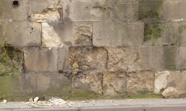 Our first examples are at The Vineyards. On the left, a drainage channel no longer throws the water clear of the stonework, allowing water to soak in and then freeze. This needs repairing urgently or the damage will get progressively worse with each subsequent frost.
On the right is another part of the Vineyards, where the more usual flaking effect can be seen. Around the new damage can be seen the older damage from past winters.
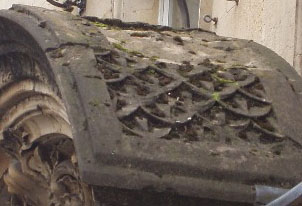 Our next example is a real pity. The beautifully carved arched entrance over Number 13 Milsom Street, which is the main entrance to Jollys, dates from 1879. It has just had some of its carving flaked off. This location is difficult to photograph from ground level (it is more visible higher up the hill, but a photograph from there needs a telephoto lens) yet this picture gives an idea of the damage which we noticed.
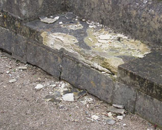 Also on a significant heritage asset, though perhaps less difficult to repair is this damage to the edge of the Assembly Rooms in the left picture.
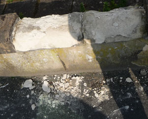 Our final set of pictures were taken in Oldfield Park. The light is not ideal in this photo on the right, but close inspection shows that two coping stones are in a very similar sorry state though one of them is in shadow so it is less obvious than the one in the sunshine.
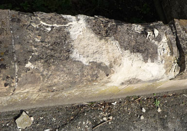 The second picture is of another piece of wall on the same property. Although not so much of the stone has broken off, there are some very visible cracks and further frost damage is likely in the future.
We understand that this is a rental property and we hope the landlord and/or the letting agency will be sufficiently concerned about the appearance of the property to make the necessary repairs soon. Now that the remaining stone contains fissures, future rains followed by frosts will inevitably cause further damage.
Go back to top index
Local Authority Historic Environment Services
Background
The Parliamentary Select Committee on Culture, Media and Sport expressed concerns regarding the capacity of local authorities to implement the reforms set out in the draft Heritage Protection Bill, published in April 2008 and requested an evidence base which will inform the introduction of the Heritage Protection Reforms legislation. The past statistics held by the Institute of Historic Building Conservation showed that between 2006 and 2008, the numbers of listed building and conservation area consents has risen, and faster than planning permissions, but during the same period there was a reduction in local authority building conservation staff.
In order to establish whether staffing levels would significantly affect local governments ability to maintain an essential element of its statutory planning services and incorporate the Heritage Protection Reforms, English Heritage and commissioned a 3-year study, to be conducted jointly by the Institute of Historic Building Conservation and the Association of Local Government Archaeology Officers, into Local Planning Authority historic environment services in England.
The first report from this study was produced in May 2009, and mostly concentrated on historical information on the changes between 2006 and 2008. The research showed that over the two year period, the number of conservation officers reduced by 7.4%. There was a smaller reduction in archaeologists, such that when the number of archaeologists was added to the number of conservation officers, the overall reduction was 5.4%. Other parts of the report investigate regional variations, and conclude that the South West has the second largest reduction, beaten only by London.
The second report, dated August 2010 is not quite so extensive, being primarily an update on the first one. It cannot replicate the regional figures exactly because local government reorganisations had resulted in 35 fewer local authorities. Similarly, the interval between reports is different, the first report covering two years and the second just 15 months. However the national figures can be compared and these show a further reduction of 6.9% in the number of conservation officers and this becomes 5.9% when the number of archaeologists is added. Overall there was a reduction of 14.2% in conservation officers over the 37 months studied.
It should be noted that the figures quoted do not include the more recent cutbacks and planned reductions following the General Election. A further report will be produced in due course to evaluate any further changes.
Conclusions
Senior members of the Institute of Historic Building Conservation, when asked to assess the impact of these statistics, have responded from different viewpoints:
The IHBC Chair, said: The loss of conservation staff will have a dramatic impact on front line services of local authority conservation teams. The projected loss of staff working in the historic environment is estimated to be on average 7% a year. Such a reduction in experienced and expert conservation staff from across local government could pose a serious threat to the economic recovery. Huge opportunities to draw in funding charitable, regeneration, tourism and otherwise could be missed. This is likely to create problems in the future for the most important asset base for a sustainable future, our traditional towns and villages. As the current research pre-dates the more recent impacts of the cutbacks, we can also be sure that the trend is only going to increase, at least in the short-term.
The Chair of the IHBC Policy Committee, said: The Coalitions ambitions for the Big Society are threatened by the loss of the Conservation Officer across local government. The Conservation Officer is our most important link between people and the places they value, whether as homes, for work or for quality of life. Conservation Officers help charities draw down funds from bodies such as the Heritage Lottery Fund; they provide a one-stop shop of advice for owners seeking to care for and improve their traditional homes; and they help ensure that local government observes its wider duties to secure sustainable development, by helping look after the most valuable of our resources, our historic places. Losing the locally informed, front line conservation specialists that help secure our economic, social and cultural infrastructure is the best way to make sure that the Big Society becomes the big confusion.
An IHBC Director, said: This research by the IHBC confirms that many local authorities still dont appreciate how Conservation Officers provide locally informed project development expertise, quality assurance and skilled professional support for statutory duties across the front line of the planning service. The ramifications of these job losses for our historic towns, villages and cities are huge. The IHBC is currently preparing advice explaining to local authorities how this reduction in conservation expertise can mean the loss of key opportunities for inward investment, increased risk of public dissatisfaction, complaints to the ombudsman and even action in law where statutory duties are not being met. Local people care about their historic places and expect councils to properly resource their care, protection and enhancement. If the councils fail in these duties, the Big Society will take on a whole new meaning.
On the Parliamentary website is the notes of the Culture, Media and Sport Select Committees Inquiry into Funding for the Arts and Heritage. There it records the evidence provided by English Heritage's Chief Executive, including his statement: I think the question is making the argument that making good conservation decisions makes good places. Good places are places where people want to live. Good places are economically successful places. Therefore, the argument that we would put to local authorities is that this is a skill you need among your officers if you are going to create an environment where people are happy, where people are prosperous, where people are stable, where you have low levels of crime, where you have high levels of tourism. This is a core skill that you need, and that is the argument that we have to make and win.
Those giving the above statements are experts. We need add nothing except to ask whether Bath, with the largest number of listed buildings of all local authorities in the country, plus the responsibility of managing a World Heritage Site, has got its staffing levels right, given the consequences of understaffing described above. We are aware that further reductions in local authority funding must be accommodated, but the regular allocation of listed building applications to staff not qualified to properly evaluate them suggests that the cuts in conservation staff have already gone too deep. The first report contains a list of duties to be carried out by conservation officers, and the ability to perform those duties rather than an arbitrary number should dictate the appropriate staffing levels.
The reports produced so far have not separately examined staff numbers performing enforcement duties because their view is that enforcement action is one part of the statutory duties of conservation officers. This does suggest that the approach adopted by B&NES, of having an Enforcement group separate from the conservation officers is wrong. Watchdog's statistics show that almost all of the enforcement cases we have reported relate to listed buildings, so enforcement does seem to be a conservation issue locally.
Go back to top index
Parnassus Project
We first encountered the name "Parnassus Project" in the World Heritage Site Management Plan, which said (in Paragraph 5.2.21):
"The PARNASSUS project brings together engineers and conservationists from the University of Bath, archaeologists from the University of Southampton, and geographers and material engineers from the University of Bristol. Researchers will survey the effects of past floods and use flood and climate change modelling tools to assess the risks of future flooding for heritage sites selected by the National Trust, Historic Scotland and English Heritage".
The implication was that there was no need to worry about the future risks and impact of flood in the World Heritage Site because the experts were studying it.
We were therefore delighted to receive an invitation from the Institution of Civil Engineers to attend a briefing on 15 February on the Parnassus Project, presented by Dr DAyala of the University of Baths Department of Architecture & Civil Engineering, the principal investigator for the project. The briefing was entitled "Effect of Climate Change on our Structural Heritage".
In a very detailed and informative two hours we learned that the project was not examining the extreme predictions of climate change but had taken the "most probable" scenario which was not an arithmetic average but a point best described as where there were as many predictions above it of worse conditions as there were predictions below it of better conditions.
Suggestions have been made (which the council seems to have taken seriously) for flood protection in Bath by means of planting large numbers of trees upstream to absorb water. Using the Parnassus figures, the winter rainfall will increase, just at the time when the trees are dormant and therefore ineffective, and decrease in the summer when the trees are in full leaf and therefore most likely to die of thirst.
It is a crackpot idea doomed to failure, and nobody should give it any further credence.
This point predicted annual totals of rainfall unchanged in any given location, but with the distribution changed so that there would be 23% less rainfall in the summer half of the year and 23% more precipitation (which includes rain, snow, hail etc) in the winter half of the year. Alongside this, summer temperatures would be 3.9°C above the norm and winter temperatures 2.8°C above the norm. These temperature changes were expected to be accompanied by an increased incidence of strong winds, but that was unquantified. Initial studies had identified the structures and materials most at risk from the consequences of these changes and the resulting freeze/thaw probabilities, and mathematical models were being constructed. These models were to be refined by actual measurements taken over a number of years in actual buildings, so that mitigation measures could be established.
We discovered that there was a difference between assumption and reality. The Parnassus Project used their initial model to identify locations and building types which would provide the best examples of real life events. None were in Bath: the locations chosen were in Tewksbury and Winchester.
We also discovered (by the direct question being asked at the end) that nobody in B&NES had ever talked to the Project, nor had the Project made any preliminary investigations in Bath. So the quotation above from the World Heritage Site Management Plan is just smoke and mirrors. The Parnassus Project will not solve the question of how Bath will protect its heritage assets from flooding, and the Management Plan must make its own policy in that respect. The true scope of the Project is summarised on the Bath University website.
Looking back on the Watchdog comments on the Management Plan we recommended that the paragraph be deleted. We hoped that advice was heeded because the above is the proof that we were right. Unfortunately when we checked the version endorsed by the council and passed via DCMS to UNESCO, it still contains that paragraph.
Go back to top index
The Recreation Ground
Amid much press speculation about what will happen to The Rec and in the light of a so-called public consultation that failed to ask the right questions and invited contributions from those who are not actually the intended beneficiaries of the transfer of The Rec in Trust to the council, we did our own research. As is common in these cases the further we dug, the more we unearthed. And as news spread that we were digging, things that we might not have discovered for ourselves were brought to our attention. This is how the research evolved.
8th May 2011
Our interest was sparked by the "consultation" of the Recreation Ground, where we expressed our doubts about the true significance of the outcome (hence the quotes around "consultation" above) because the covenant of 1956 transferring the Rec was for the benefit of "the Mayor, Aldermen and Citizens of the city of Bath" and yet nowhere in the questions asked is there a requirement to say whether the respondent falls into any of those categories.
We maintained our view that the consultation document arguing that the Sports Centre breaks the covenant so an extension to the Bath Rugby area can be made acceptable is not a sound position to take. It is rather like saying because a road through Bath has been wrongly marked with a 40mph sign instead of a 30mph sign, by arranging to have the speed camera turned off it would then be acceptable to drive along it at 60mph. Like the arguments being put forward in the Rec consultation document, it is absurd. The legal ruling interpreting the Rec Covenant referred to that specific area of land as conveyed, making any proposals for land swaps ineffective. If the trustees cannot understand that, then arguably they are not fit to be trustees. They should be vociferously trying to enforce the covenant in the manner that the 2002 court ruling interpreted it. That is what trustees are for. Why are they not doing that?
15th May 2011
An Acre = 4840 Sq Yd
A Rood = 1210 Sq Yd
A Perch = 90.75 Sq Yd
Thus the Rec is defined as 80858.25 Sq Yd or thereabouts, approximately 6.76 Hectare
In the intervening week we informed that there is a second covenant dated 1922 which binds the owner of "All that piece or parcel of ground situate in the City of Bath and containing an area of Sixteen acres two roods and eleven perches or thereabouts and known as The Bath and County Recreation Ground ... " and anybody else the land is subsequently sold, assigned or otherwise transferred to, in perpetuity, to a restriction "that nothing shall be hereafter erected placed built or done upon the said hereditaments and premises ... which may be or grow to be a nuisance annoyance or disturbance or otherwise prejudicially affect the adjoining premises or the neighbourhood". We have also been informed that there are moves afoot to try to revoke this covenant but we have not been able to confirm or deny that by the time this was written.
What this covenant apparently means is that the description used (an area of Sixteen acres etc) removes any possibility of a land swap (whether with the Lambridge site mentioned in the consultation or any other location) being used as a mechanism to get round the restrictions on developing the Rec, and that "the neighbourhood", which the dictionary defines as "the immediate environment" and would normally be interpreted as all buildings closely surrounding the Rec plus any others in line of sight or within earshot, have a legal veto on any development for business purposes that could be (there is no obligation to prove that it will be) a nuisance annoyance or disturbance or prejudicially affect (which would include affecting the property value) themselves or their premises.
It seems unlikely that everybody in "the neighbourhood" will willingly surrender their protection under this covenant; and nowhere in the document is there a suggestion that "the neighbourhood" has to defend its rights (or even know about them) in order to retain them. If any reader regards themselves as being covered by the words "the neighbourhood" and has not been asked for their opinion on surrendering their rights, we suggest that they contact the Trustees of the Recreation Ground (who are the currently assigned guardians) and ask what the Trustees are doing to ensure that the neighbourhood's rights remain in place and can be enforced.
We have seen a copy of the covenant document and have checked that our quotes above are accurate. We will attempt to get the full text of the covenant into a form that can be reproduced on-line so that the quotes can eventually be read in their full context. Meanwhile, if anybody does get a statement from The Trustees and wishes to inform us of what was said, please use the details on our Contact Us page.
29th May 2011
A week later and there are further developments. The Recreation Ground has new Trustees. The Chronicle has announced that Cllrs David Dixon, Tim Ball and Nathan Hartley have taken over from Cllrs Chris Watt, David Hawkins and Vic Pritchard, the trustees under the previous administration. We were also contacted to say that some letters had been received about plans for the Rec, and asked if we wanted to see them (which of course we did).
We were shown two pieces of correspondence, one on Bath Rugby headed paper and the other on paper carrying the name of a local solicitors practice. Both are similarly worded, and try to pretend that the people who benefit from the 1922 covenant need to have had the benefit expressly conveyed in any sale since 1922. It also claims that anybody attempting to retain the protection of the 1922 covenant would be a defendant, and by implication liable to costs if the defendant loses.
Protective Costs Order
It is UK (and EU) policy that if a case should be heard in the public interest, the public should not be deterred from lodging the case by the fear of having to meet all the costs if the case is lost. A judge can grant grant a Protected Costs Order which limits the exposure to costs if the case is lost (if the case is won, the costs are met by the other side).
These letters look like an attempt to browbeat the opposition with false claims. Any individual taking court action to protect the covenanted rights of the neighbourhood would have an obvious claim to be acting in the public interest and so should automatically qualify for a Protective Costs Order (see box, right), leaving Bath Rugby to bear all their own legal costs even if they win. However, they are not likely to win:
Firstly, the covenant is not attached directly to the surrounding properties as the correspondence suggests, it is attached to the land known as the Recreation Ground. The Recreation Ground was last conveyed in 1956 for the benefit of the citizens of Bath, and because the 1922 covenant was expressly added to the 1956 conveyance of that land forming an unbroken chain of assignments, then the current owner, B&NES, and therefore the Trustees are obliged to both enforce the 1922 covenant and to protect its applicability:
"The Purchasers for themselves their successors and assigns hereby covenant with the Vendor his successors in title and assigns and to the intent and so that this covenant shall run with and be binding on such portions of the hereditaments and premises hereby conveyed as are respectively affected thereby into whosoever hands the same may come ..."
A 2002 High Court judgement (BATH AND NORTH EAST SOMERSET COUNCIL v HM ATTORNEY GENERAL)
clarified the status of the Recreation Ground, so the current situation has recently been tested in a court, and that case will have tested claims and counterclaims against all relevant legislation prior to that date. The text of that judgement is evidence that the court recognised the existence and relevance of the 1922 covenant. The threatened Declaration is to claim that the covenant is unenforceable, but The Recreation Ground Trust, Bath is able, and duty bound, to enforce it. It only requires them to refuse permission for unpermitted buildings. The ability to enforce was evaluated in the 2002 court judgement, and that must be taken into account in any future proceedings. However that judgement made no ruling regarding the current use of the Rec: "That conclusion in no way pre-empts the question whether the actual uses to which the claimant has put the Recreation Ground, in particular the most recent letting of the football ground, are compatible with the charitable trusts. That is a question which this judgment does not seek to answer." The existing use cannot therefore claim any legitimacy from this judgement.
Secondly, the surrounding premises who wish to protect their rights under the covenant are witnesses not defendants, because their premises are "the neighbourhood" which is protected by the conveyance, and not part of the conveyed land. The neighbourhood has a legitimate expectation that the trustees should protect their rights and "no workshops warehouses factories or other buildings for the purpose of any trade or business" is part of that collection of rights. While Bath Rugby was an amateur club, the erection of clubhouse and stands were not forbidden as part of a business; but a privately owned professional club is a business and is excluded from further construction by the covenant. If the Council or its Trustees does not oppose the Declaration, then each and every household in the neighbourhood is entitled to claim damages from them for maladministration if the rights given them in the 1922 covenant are not used and any subsequent development for business purposes which the Trustees do not oppose creates "a nuisance annoyance or disturbance or otherwise prejudicially affect the adjoining premises or the neighbourhood".
Thirdly, the correspondence we saw claims that the council have raised no objection. But of course that was when the former Trustees were in office, and probably they were not made aware of the possible penalties for inaction.
It is likely that the new Trustees, if they are made aware of the risks they run (as outlined above) should they raise no objection, might take a different view. They should also bear in mind that the Charity Commission has only reviewed the presence of Bath Rugby in the context of the 1956 covenant, because the 1922 covenant was not mentioned in that paperwork and yet even so that review resulted in a directive from the Charity Commission which is still extant: "The Commission directs that ... BANES demonstrate that it has discharged its responsibilities as charity trustee in respect of any decision relating to the current and future uses of the Rec and the resolution of issues arising from the Recs current occupants and that such decision was properly taken by BANES in the best interests of the Charity". Council Tax payers must hope that they do make responsible decisions. The risk of numerous damages claims from "the neighbourhood" (probably each covered by a Protective Costs Order) cannot possibly be in the best interests of the charity, regardless of how beneficial they regard Bath Rugby as a tenant, particularly when the council's annual financial statement admits "The Council as Trustee is ultimately responsible for any liabilities or deficits incurred by the Trust".
The new Trustees appear to have inherited a real hot potato, thanks to the failure of the outgoing Trustees to operate the charity independently of the interests of others. It is an unfortunate fact of life for Bath Rugby that although they can't be arbitrarily removed from that part of the Rec for which they have a lease and they would not have been in their current position regarding additional facilities on the Rec if they had remained an amateur club, nevertheless such sentiments do not override the council's need to now administer the charity in the way that the High Court ruled that it should be administered. Our expectation, from our researches to date, is that neither the courts nor the Charity Commission are likely to support the Council and its Trustees if they take any action other than opposing the aspirations of Bath Rugby on the heavily covenanted Recreation Ground. The Charity Commission has ordered B&NES to (among other things) "act in good faith", and to do that the Trustees must remember that the beneficiaries of the Trust are "the Mayor, Aldermen and Citizens of the city of Bath" and those covered by the description "the adjoining premises or the neighbourhood" of the Recreation Ground, and not Bath Rugby or its supporters from other parts of the country.
3rd February 2013
Several news items appeared in the press at this time, all relating to The Rec.
First there was the news of an application for Town Green status. Given that the Recreation Ground was last conveyed in 1956 for the benefit of the citizens of Bath, and because the 1922 covenant was expressly added to the 1956 conveyance of that land forming an unbroken chain of assignments, then the current owner, B&NES, and therefore the Trustees are obliged to both enforce the 1922 covenant and to protect its applicability, and that in 2002 the High Court upheld the conditions of the 1956 conveyance, Mr Sparrow who lives in Bathwick in the neighbourhood of the Rec is entitled by the 1922 covenant to enforce a restriction "that nothing shall be hereafter erected placed built or done upon the said hereditaments and premises ... which may be or grow to be a nuisance annoyance or disturbance or otherwise prejudicially affect the adjoining premises or the neighbourhood". A Public Inquiry into a Town Green must be cheaper for the Trustees to service than another High Court case which would arrive at the same conclusion as the 2002 hearing, and which remains an option if the Town Green application fails. For a Trustee to dismiss this action as "a stalling tactic" simply demonstrates that he has not properly understood his role as Trustee as distinct from councillor, has not studied the legal judgements, and has not complied with the instructions of the Charity Commission: "The Commission directs that ... BANES demonstrate that it has discharged its responsibilities as charity trustee in respect of any decision relating to the current and future uses of the Rec and the resolution of issues arising from the Recs current occupants".
The second Chronicle Item is the news of the Charity Commission consultation. The problem is that the consultation is not a popularity contest, and the size of the majority is irrelevant. The 1922 covenant is binding and it places conditions on a specific piece of land, not any mixture of sites as suggested in the consultation. The Charity Commission will be acutely aware that if they vary the Trust and place it in conflict with the 2002 High Court Judgement, they can be accused of maladministration, or even contempt of court, as indeed can the Trustees. They will also be aware if they study the documentation, that the neighbourhood has a legitimate expectation that the trustees should protect their rights and "no workshops warehouses factories or other buildings for the purpose of any trade or business" is part of that collection of rights. While Bath Rugby was an amateur club, the erection of clubhouse and stands were not forbidden as the amateur club was not a trade or business; but the current privately owned professional club is a business and is excluded from further construction by the covenant. If this is ignored, then each and every household in the vicinity of the Rec can sue for damages if they feel they are, or even could be, prejudicially affected.
The third Chronicle item is a letter from The Bath Society, effectively accusing the council of misleading the public by only advertising that opposition to the Town Green is possible without also informing that support comments for the application is also possible. The sheer scale of 25,000 spectators (Bath Rugby's original target, and probably still the ultimate goal) as described at the end of the letter, is an eye-opener.
We have gone into some detail here to emphasise that although the Rec is held in trust by the council, it is and must remain completely separate from the council's own plans and aspirations. To do otherwise risks significant court costs in the future, and a council already struggling with a tight budget would be acting recklessly if taking any path that could lead back to the High Court. It may not be to their liking, but the council is bound by the signature that was placed on the 1956 conveyance, to which they are successors in title. They should be vociferously trying to enforce the covenant in the manner that the 2002 court ruling interpreted it. So should the Trustees.
Go back to top index
At the end of October 2013, the Board of Trustees met to appoint additional Trustees. This follows an agreement by the Charity Commission that the number of Trustees could be increased.
The following now manage the Bath Recreation Ground Trust:
Councillor David Dixon [Cabinet Member for Neighbourhoods] (Chair)
David Durdan [Somerset County Playing Fields Association] (Vice-Chair)
Councillor Tim Ball [Cabinet Member for Homes and Planning]
Don Earley [Fields in Trust]
Stephen Baddeley [Director of Sport, University of Bath]
Elizabeth Bloor [Netball South West & Chair WESPORT]
Derwent Campbell [Mogers solicitors]
Simon Emery [Emerys of Bath Ltd]
Geoffrey Fairclough [Chartered Accountant]
Michael Laughton [Registered Auditor and Chartered Accountant]
These 10 Trustees bring a variety of backgrounds and skills rather than being wholly made up of councillors as the original Board was.
Go back to top index
On 27th and 28th September2013, Bath Rugby held a public exhibition to show the results of the first thoughts on how the Rec could accommodate 18,000 spectators rather than the current 12,000 capacity. This exhibition was at the concept level, in that it showed where the seating would be, but there were no design proposals showing what the structures holding the seating would look like. In a nutshell the exhibition showed that the South Stand would remain, but alongside it some additional seating is proposed. The temporary East Stand remains. The North Terrace (with its back towards Johnstone Street) and the West Stand (with its back towards the river) would be replaced with new facilities with more seats, and the current Club House is to be demolished and replaced. There was a stated wish to improve how spectators get into and out of the ground, but there were no details of how that was to be achieved.
There were feedback forms at the exhibition and the exhibition material was put on-line with an on-line feedback form. The aim of this exercise was to gauge public opinion and to seek suggestions and ideas about the refinements the public would like to see.
This was followed by a second public exhibition on 15th, 16th and 17th November 2013, with additional information on the exhibition boards including some artist's impressions. It was noted that the capacity was stated to be 16,500 this time.
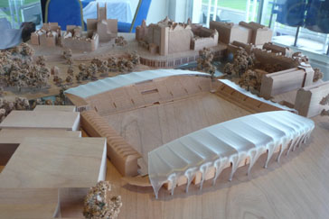
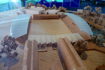 The greatest help given to visualising what was proposed came in the form of a scale model, showing the development in the context of the surrounding area. This model was not perfect in that the slopes of the land were not able to be properly reflected in the model in the time available to prepare it, but it did allow the appearance of the development to be assessed from a variety of viewpoints. Out photos of the model used here (looking towards the Empire on the left and looking from the Johnson Street direction on the right) are helpful, but are no real substitute for viewing it and walking around it.
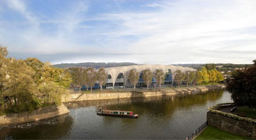
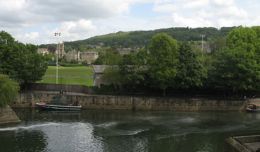 The Chronicle published some of the artist's impressions and we have attempted to match one of the views with a current photograph so that a direct comparison can be made.
We were informed that what we were seeing is still work in progress, and there would almost certainly be further alterations as a result of the feedback collected from the visitors to the exhibition and from those who viewed the exhibition material on-line.
Go back to top index
Moorland Road - Going, Going, Gone
When it was discovered that there were aspirations to demolish Oldfield Park's "Tin Tabernacle", some of the local residents tried to get it listed on the grounds that it was the last remaining one of its type within the World Heritage boundary. English Heritage acknowledged that it was of local importance, but declined to list it because they didn't consider it to be of national importance.
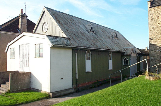 On 14 June 2007, outline permission 07/00287/OUT was granted for the demolition of the Oldfield Park "Institute Building" and its replacement with a 4-bedroomed house.
The planning application was an outline one, contrary to the Local Plan in force at the time that said outline applications for developments in a conservation area are not acceptable. The DCC nevertheless ignored its own planning policy and approved it, yet gave no reason in the minutes why they did so, despite the agenda explaining that it was before the Committee because it was controversial.
The permission granted was with conditions, the first of which said the permission would time expire after three years unless development had begun. Three years later, almost to the day, demolition started, presumably in an attempt to prevent this time expiry, so that the property could be marketed as a plot with planning permission.
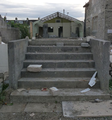
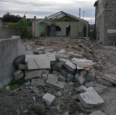
These pictures were taken during the demolition. No attempt seems to have been made to recover or recycle anything. The "Alleygator" gate on the left of the photograph below, installed at the council's expense, has been rendered ineffective by the removal of the building alongside it. It is an interesting question who becomes responsible for restoring the security that the gate should be giving to the neighbouring properties.
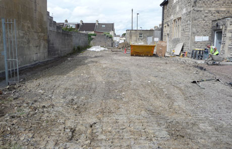 Finally (pictured right), nothing was left except a cleared and levelled plot of land, put up for auction as a building plot with planning permission. The auction catalogue didn't mention that the planning permission is only in outline, it didn't mention that the presence of a large sewer pipe under the plot makes building on this site problematical, and it certainly didn't mention that the planning permission had associated conditions that do not seem to have been met, making the demolition
a potential enforcement issue. However, Enforcement replied that the site was outside the Conservation Area and was not classed as a Locally Important Building and therefore the demolition falls into the category of "Permitted Development".
Finally (pictured right), nothing was left except a cleared and levelled plot of land, put up for auction as a building plot with planning permission. The auction catalogue didn't mention that the planning permission is only in outline, it didn't mention that the presence of a large sewer pipe under the plot makes building on this site problematical, and it certainly didn't mention that the planning permission had associated conditions that do not seem to have been met, making the demolition
a potential enforcement issue. However, Enforcement replied that the site was outside the Conservation Area and was not classed as a Locally Important Building and therefore the demolition falls into the category of "Permitted Development".
The conditions that were imposed include:
• Approval of the details of the landscaping of the site shall be obtained from the Local Planning Authority in writing before any development is commenced.
• No development shall commence until samples of the materials to be used in the construction of the external surfaces, including roofs, have been submitted to and approved in writing by the Local Planning Authority.
• No development shall take place until a construction method statement has been submitted, to include details of storage of plant and materials and access arrangements for the gated footpath to the south of the site.
We can find no record of any of these conditions being satisfied. The conditions were not met before the three year limit expired, but there was a new application (10/03335/FUL) which was given permission, which effectively replaced the outdated one. There was a sign on the site early in October advertising that it is going to auction with planning permission for development.
Go back to top index
Former Labour Exchange, Milk Street
 The Genesis Trust has been moved several times in the past. Each time it was because the council required them to move. In 2004, they went through the expense of securing planning permission and then moving into Green Park House. Then when the council decided to sell Green Park House, they were moved into part of the Newark Works (a large impractical space, impossible to heat adequately and full of echoes, but better than nothing), until the council wanted to offer the proposed Dyson Academy vacant possession and the trust was given just three weeks notice to move out and into the former Labour Exchange, which has proved well suited to their needs.
Each move cost the charity a four figure sum. This was money that could have been much more valuably spent on the work of the charity. Also, because the charity deals with some of the more insecure and vulnerable members of society, some of whom find change difficult, each relocation has created additional work for the charity, as well as costing them money.
And now the Genesis Trust has been told to vacate the former Labour Exchange building in June 2014. Despite the suggestion in the budget statement of accommodation identified in Walcot Street, the Trust has had no offer of such accommodation, they doubt whether any premises in Walcot Street will be of sufficient size, and they also doubt whether anything of sufficient size will be affordable. They certainly have concerns about whether a new set of relocation costs are affordable.
It appears to us as though the council has a total disregard of the value of this charity, using them simply as pawns to be moved at whim. Churchill famously said "Once is happenstance, twice is coincidence and three times is enemy action". On that basis, it appears that the council is knowingly harming the work of the Genesis Trust, and the Trust has a valid argument to make under the Equalities Act to stay put in a facility they have occupied for over five years, or for compensation if they are once again forced to move. The council also has to consider that if the Genesis Trust has to scale back its activities, then the people it can no longer help will be the responsibility of the Social Services Department, and nowhere in the budget is the additional staff or funding for such an influx catered for.
The Trust informed us that the building had recently been surveyed, and the surveyor was under the impression that only part of the building is listed. Either the surveyor has been wrongly briefed by the council, or else he wasn't qualified to form an opinion on a listed building. The definition in the legislation is abundantly clear that the listing applies to the entire building and all of its curtilage. What is more, in this particular case the building in its current form is the reason for listing it, so no visible modifications would be compatible with its special character.
Given that the reason why the Genesis Trust has been given notice to quit is for a scheme that cannot be approved under planning law as currently written, the obvious answer is to give the Genesis Trust a proper lease on the current building so that they can remain there indefinitely. Bath is so much more than a few Georgian buildings and a Victorian interpretation of Roman bathing, and the Trust would benefit enormously from the building from which they currently operate being promoted as a tourist attraction showing wartime ingenuity.

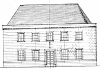 When it was built in 1936, this fairly modest building of two stories under a hipped slate roof was erected on the site of Nos.1-3 James Street West, a road that at that time only went as far as Milk Street. Although the street directories at that time referred to it as "Bath Labour Exchange", it was large enough to hold other council functions, hence the reference to Weights And Measures in the listing description. It opened for business in 1937, and with the outbreak of World War 2 in 1939 its function was extended to become a Help Point to assist anybody bombed out of their home or their place of work. It also ensured that all unmarried women were employed on functions that assisted the war effort. At first such women were asked to volunteer, but later there was legislation to make such employment compulsory. Women could ask for a different job to the one to which they were currently allocated, so the Labour Exchange maintained lists of vacancies to choose from.
Although the war was some 70 years ago, most of the records kept at the time still exist and it is possible to piece together the history from the records of the Ministry of Home Security retained in the Home Office archives and from the council records of the time still held in the Guildhall and the Central Library. Supplementing these are a number of oral histories and written memories, plus several books on Somerset and Bath at war and two valuable university papers, one submitted to the Bath Spa University giving an analysis of the German archives relating to the raids on Bath, and one from the Stephen F. Austin State University in America which drew conclusions from the notes and minutes that were supplemental to the main Ministry of Home Security files.
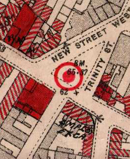 In the early morning of 26th April 1942, Holy Trinity Church (which was roughly where McColl's now is) was hit by a 250Kg bomb, and shrapnel and stone fragments from the church would have caused minor damage to the Labour Exchange. At 1:50am on 27 April 1942, the third raid of the Baedeker raids on Bath started, and at 2:00am a bomb landed on the triangle opposite the Labour Exchange and the Bath Wholesale Fruiterers premises. The solid red on the map shows the buildings damaged beyond repair and the hatched red shows the buildings badly damaged but believed able to be salvaged. From the Civil Defence archives we know that there were numerous fires started in the area, and that over 2400 incendiaries accompanied the 126 high explosive bombs that fell that night, but whether the fire that started in the Labour exchange was caused by incendiaries or a fractured gas main is not recorded.
What we do know is that four minutes after the high explosive bomb landed, a turntable ladder appliance was dispatched to the Labour Exchange, so there was somebody trapped either in the upper floor or more likely there was a firewatcher on the roof who needed rescuing. That rescue appears to have been successful because nobody died in the building. According to the records the wooden bed supporting the roofing slates burned fiercely and quickly, and the upper storey burned out, but the ground floor mostly survived. This "top down" fire characteristic suggests it was caused by incendiaries.
The oral history of a Civil Defence Messenger who was tasked with guiding fire crews from outside Bath to their allocated fires reveals that after dropping all their bombs, several of the planes machine-gunned the streets to hamper the emergency services, and the memoirs of a lady who lived in Milk Street shows that the Labour Exchange was targeted in this way and was hit, so we know that the damage to the building was caused by a mixture of blast and shrapnel from bombs, debris from bombed buildings, road fragments thrown up by the bomb opposite, and machine gun fire.
The Fire Service records show several fires in the immediate area that night, such that 10 pumps were considered necessary, but only nine could be made available. The records also show that the hydrants in the area couldn't cope with the demand, and the two static tanks nearest the Labour exchange were emptied that night and had to be refilled the next day. The last fire pump left around noon the next day, having completed that task.
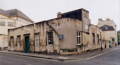 This combination of circumstances could explain why the whole of the upper floor burned out. The upper storey had a concrete floor, and this appears to have protected the ground floor from the heat above. The damage records reveal that the Labour Exchange needed immediate evacuation and nobody should be allowed in until it had been made safe.
What followed was an urgent "make do and mend" repair. The floor of the upper storey was sealed to keep the rain out and thus it became a roof, the hole in the wall was patched with cement completing the repairs immediately necessary to make it weather-proof, but the shrapnel and machine-gun damage was left unrepaired. The Labour Exchange, a function too important to lose and with the Help Point in greater demand because of the bombing of houses and places of work, continued to operate from the stump of the building.
After the war, with some 16,000 damaged buildings in Bath, the priority was to provide housing for those bombed out, and places of employment so that the residents had a source of income. Repairing a council office that was functioning adequately with just emergency repairs was not a good use of scarce materials or money, and only the damaged windows were replaced (by exact copies of the originals made in Walcot Street) once the blackout requirement was lifted. Once the Labour Exchange use ended, other mainly storage uses were found, so there was no requirement to restore the building, and it survived as a rare example of wartime ingenuity in the face of catastrophic damage, and it was listed at the request of the Bath Blitz Memorial Project for that reason.
That listing should now protect it from any visible modification. But it needs to remain in use, because without the heating and ventilation that accompanies regular use it could otherwise deteriorate. The current occupants place minimum demands on the building, and that makes them ideal to preserve it.
Go back to top index
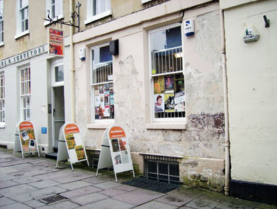 Success Story 1 - Bath Festivals Box Office
This one is not our success, but worthy of a mention because of the outcome.
In the Western Daily Press of 12 April was a letter from Keith Davis thanking the council for its prompt action, pointing out that within four days of his article in that newspaper commenting on the state of the Festivals Box Office building a contractor was on site and made a big improvement.
We contacted Mr Davis for information on exactly what work has been done, and he provided us with a set of photographs which we reproduce here ("Before" on the right, "During" and "After" below). And we add our own "well done" to his.
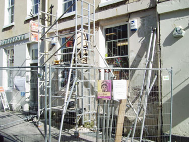
Go back to top index
 Success Story 2 - St. James Cemetery
As part of ongoing work to find structures worthy of listing, we took a look at the listing description for St James' Cemetery and discovered that the important northern boundary wall was not listed. According to the wartime records, although the cemetery itself received some bomb damage, apart from losing its railings for the war effort, that wall was mostly undamaged and could be considered original. However, an examination of the legislation left the question of whether it was curtilage listed as part of a cemetery containing listed structures (the Chapel, and the Lodge and Gateway, pictured here, were separately listed in 1975) was inconclusive, so we decided to ask English Heritage to clarify the situation.
A Watchdog member carried out some research and satisfied that the wall was commensurate with the construction of the entire cemetery complex, applied to English Heritage for the existing entry to be extended. We have now received the good news that English Heritage agreed with our research and has included the wall with the listing entry for the gatehouse and lodge at Grade II.
 The English Heritage report states:- The northern boundary wall for Widcombe, Lyncombe & St James' Cemetery is attached to both sides of the Grade II listed entrance lodge and gateway. The buildings and the wall are of a high architectural quality and craftsmanship and were designed in an elaborate French Gothic style similar to the Grade II listed cemetery chapel which is located at the centre of the cemetery. All the cemetery buildings, including the northern boundary wall, were laid out in a single phase and designed by the architect C E Davis.
The northern wall fronts Lower Bristol Road and is a visible historic feature within the streetscape. It provides a clear boundary to the cemetery and is largely intact; it retains its carved piers, rock faced dwarf wall and ashlar coping but has unfortunately lost its iron railings.
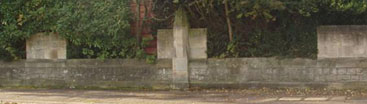
A mile plate is fixed to the most westerly octagonal pier and reads '1 Mile From The Guildhall, BATH'.
Listing Entry 446451, which used to cover just the Lodge and Gateway, is thus now extended to include the entire wall, both sides of the gateway, as Grade II listed structures. We are delighted that this clarification of the exact status of the wall has now been made.
Go back to top index
 We Were Right -
San Francisco Fudge Factory
We commented on two planning applications for the San Francisco Fudge Factory. 09/02694/FUL was for the erection of a new shop front, and 09/03184/FUL was for tables and chairs in front of it.
The shopfront we supported, and we are delighted to see that the finished article is every bit as attractive as we imagined (see picture).
The tables and chairs we objected to, and we take no pleasure in seeing that the shiny chrome looks every bit as out of place against such a traditional shopfront as we feared.
We Were Right -
Illumination on Listed Buildings
We have consistently stated that standardised corporate branding is sometimes inappropriate for Bath. We have consistently opposed unnecessary illumination on listed buildings, and often Case Officers have agreed with us and have negotiated out the proposed lighting scheme. However we are reliant on volunteer effort to prepare our comments on planning applications and we sometimes cannot cover everything that is worthy of comment. On some we have to trust the Case Officer to imagine what we would have said if only we had the time to say it.
 It is disappointing that this did not work for the Mcdonald's application for the Lower Bristol Road. Because the same lighting technology had been used on St Stephen's Church, it was considered acceptable to use elsewhere. The difference is that the church is in a prominent position and is a landmark view that merits being visible after dark, whereas Mcdonald's is a modest two storey building in a relatively low light area with only local visibility.
This photograph was sent to us by a local resident who complained that the bright light was penetrating into the bedroom and affecting the quality of sleep. Once a planning decision is made, it is very difficult to unmake it, so this problem will persist. But our examination of the application documentation shows that the lights are described as dimmable, so perhaps it might be possible to negotiate the intensity being lowered.
There must also be a possibility that Mcdonalds might have second thoughts about switching it on. Because of the glare, the building doesn't look like a restaurant at all and draws attention away from the extension which does, and it could have an adverse impact on passing trade. After all, this is not a brightly lit shopping mall this is suburban Bath, and passing motoring customers are likely to be so distracted by the glare after dark that they don't notice any other signage. Time will tell.
Go back to top index
Restored Coal Wagon
As part of the Southgate Development, permission was granted to demolish the ramp beside Bath Spa Station to open up the vaults beneath it and to create Brunel Square.
When the vaults were examined as part of the historical survey, it was discovered that one of them had a chute that would have connected that vault with the goods shed that would have occupied the space at platform level, had it not been covered in tarmac for parking. Inside the vault was a narrow gauge wagon that would have taken coal brought into the station along the main line and dropped down the chute, along a 50cm gauge track to the power station behind Churchill House. The wagon was mostly complete but needed restoration (see picture 1). The first stage was to stabilise the wagon so that it did not deteriorate any further (see picture 2), and then to restore it retaining as much of the original as possible (see picture 3).
Picture 1 |
Picture 2 |
Picture 3 |
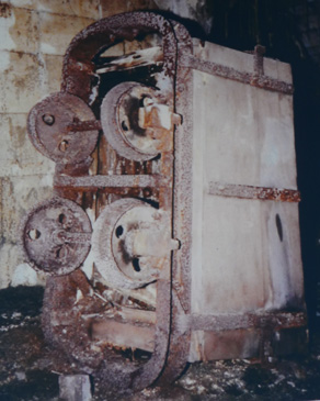
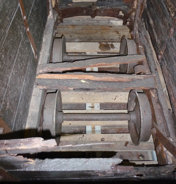
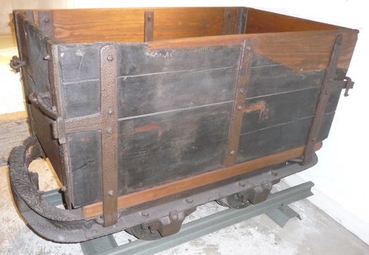
The newly restored wagon was installed in the Museum of Bath at Work, and was unveiled on 1 April 2017 with speeches by the Chairman of Bath Council, the Chairman of the museum trustees, Cllr Neil Butters (speaking as a representative of the Heritage Railway Association rather than as a councillor) and Sir Peter Hendy of Network Rail (which funded the restoration, carried out by Cambrian Transport).
Go back to top index
Powlett Court
Powlett Court is a small, currently pedestrians only, footpath connecting Powlett Road to Bathwick Street. The council is proposing that it should be made an official cycle track.
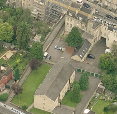 The press release refers to an "informal consultation" and only residents who live near the path have been written to and asked to make their views known. A lot of people use this route as a short cut, and yet don't live near enough to receive a letter, so we are giving the consultation some publicity here; it does not appear on the normal list of consultations so we would guess that a lot of people potentially affected by this are unaware of it.
The picture shows that the path is narrow, bounded by a wall at each side and is the length of two gardens. From one end to the other it is about 80 paces or so. It is just wide enough at the ends for a pushchair from each direction to squeeze past each other, and it is slightly wider in the middle.
The justification given by the Cabinet Member for Transport, is "the Council is legalising a situation which has existed for many years with a view to making safety improvements that will benefit all users of the path." There are two things wrong with this.
The first is that all the while bicycles are not supposed to be ridden along the path, those who do so illegally are likely to be careful not to do so in a manner that endangers other users of the path. Once it becomes an official cycle track there will be some that because it is legal to ride along it, use it at speed and put pedestrians at risk, particularly children who have little concept of danger and may be walking alongside a pushchair, the blind and partially sighted and those unsteady on their feet. This cannot possibly benefit all users.
The second thing wrong with the statement is that just because something has been practiced illegally for a long time, it is not a sound reason for making it legal. Alcohol has been bought by those underage to do so for many years, but a long duration doesn't make it right. Prostitution is not legal, but has been around so long that it is referred to as the oldest profession. The number of drivers caught by speed cameras shows that speeding is widespread, but removing the speed limits is not the appropriate way to deal with it. In the same way, if cyclists ride on pavements and along footpaths in defiance of legislation, then legalising it along Powlett Court because they can't be bothered to dismount and walk 90 metres is not the appropriate response.
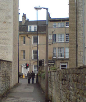 The Cabinet Member for Transport should always give more priority to the safety of pedestrians than to the convenience of cyclists, to save cyclists perhaps 45 seconds of journey time in this particular case. If pedestrians and cyclists are to share this path, it must be on the understanding that pedestrians have absolute priority and in the event of any accident, the cyclist is automatically at fault. But the correct action to take is to abandon the proposal and leave this as a pedestrian footpath.
Unfortunately, by the underhanded way the consultation has been "informally" conducted, it looks as though the consultation was meant to produce so few responses that the decision already covertly made can be rubber stamped. So if you use this path on foot, make sure you register your objection to the council.
After we wrote the above item, we were sent the photograph on the right which is a nice illustration of the width of the footpath compared to the space occupied by pedestrians. This couple is walking closer together than many couples do, and they nevertheless occupy a fraction more than half of the width at that point. That point is not the narrowest part of the footpath. The narrowest part is at the other end, and it is 7 feet 4 inches or 2.24 metres at that end.
We also received an e-mail criticising our choice of words "official cycle track". Given the Cabinet Member for Transport has freely admitted to the press that cyclists already use the path despite the signs saying they are banned from doing so, which makes it an unofficial cycle track, our choice of words to make the contrast seems entirely appropriate.