
Railway Road
(Picture supplied by Mrs Stockley)
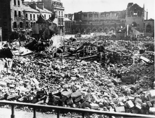
Three bombs fell in this area to cause this damage: HE2023 which fell to the east of Railway Road and to the south of Stanley Road, HE2024 (listed as Manvers Street) which fell slightly further south, and HE2025 which landed in from of Fortt's biscuit factory in Manvers Street.
In the picture above, the buildings top left are the north side of Stanley road, and the building in the background, top right is Fortt's biscuit factory. Just off the right hand edge of the picture are the remains of the Salvation Army Citadel, which was used as a Rest Centre. Click on the picture above to read the memory of a resident of Stanley Road.
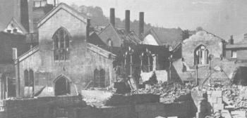
The picture above shows a closer view of the Salvation Army Citadel.
(Picture taken by N Harbutt reproduced with permission of Bath at Work Museum)
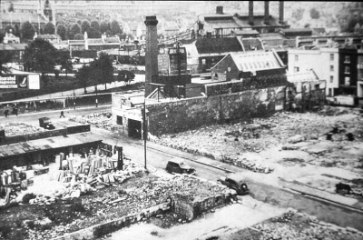
The picture above shows the site after clearance. Railway Road is the street with the parked cars. The square brick chimney is part of the Co-operative Dairy, and the three round chimneys in the background belong to the City of Bath Electricity Department (the generating station behind what is now known as Churchill House).
Use this button to view the picture pages in sequence.
If you can't find where you want to go next using the navigation buttons at the top of this page, this button will take you to the page containing the complete site index.